Snazzy Snaps & Travel Tales
Welcome to my travel blog! I've visited 30 countries (kickstarted by Remote Year) and 38 U.S. States. Click SUBSCRIBE to receive an email when a new post is published.
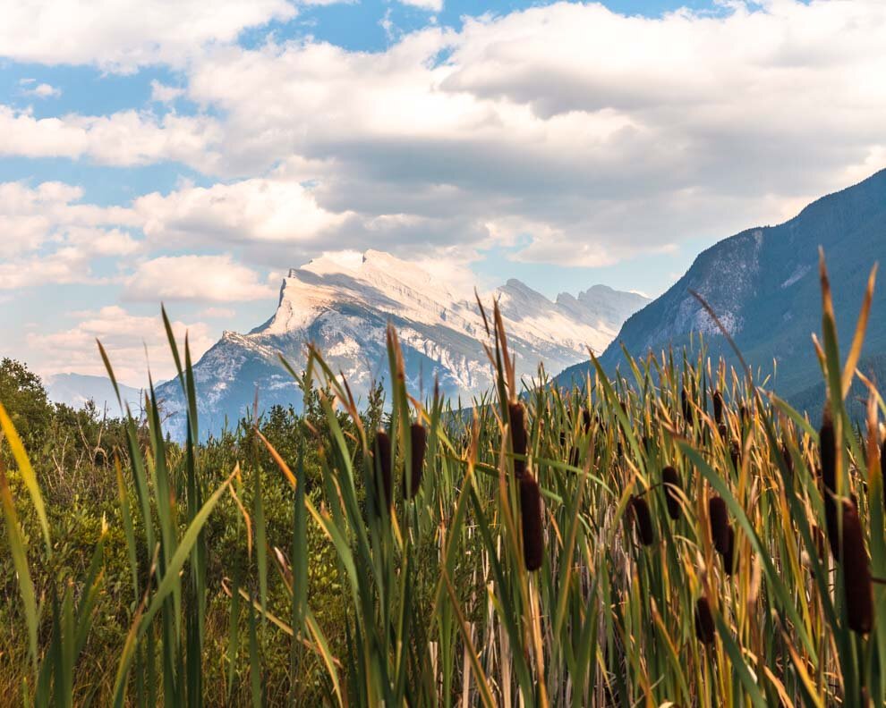
Canadian Rockies Pt 3: Jasper National Park and the Icefields Parkway
To round out my 3 part Canadian Rockies series, it’s the home of Spirit Island—Jasper National Park! A true gem that deserved even more of my time. What I saw left me wanting more! I will return…

Jasper National Park
JASPER is a cool name and this national park lives up to the cool name!
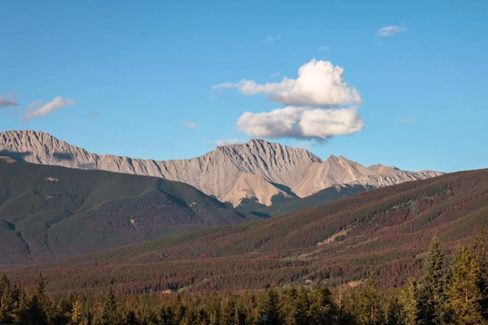
Most of the features of Jasper are off of the Icefields Parkway, which is such a gorgeous drive! More info on Wiki
Only spent a couple days in Jasper, as I was nearing the end of my road trip in the Rockies.
Check out some of the cool stuff I saw:
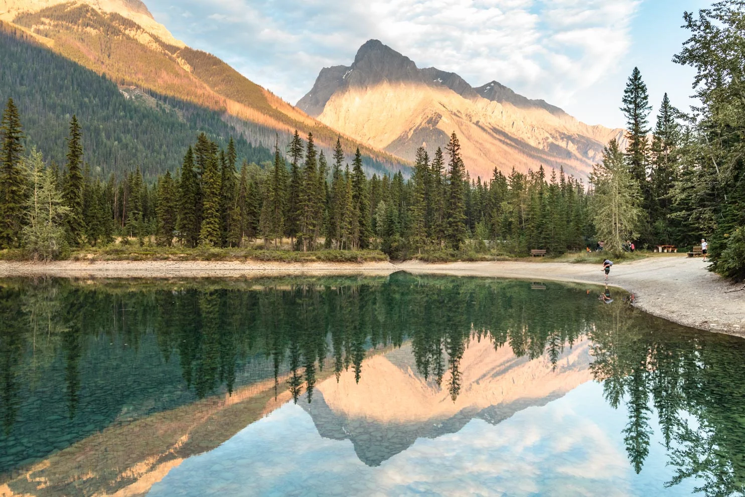
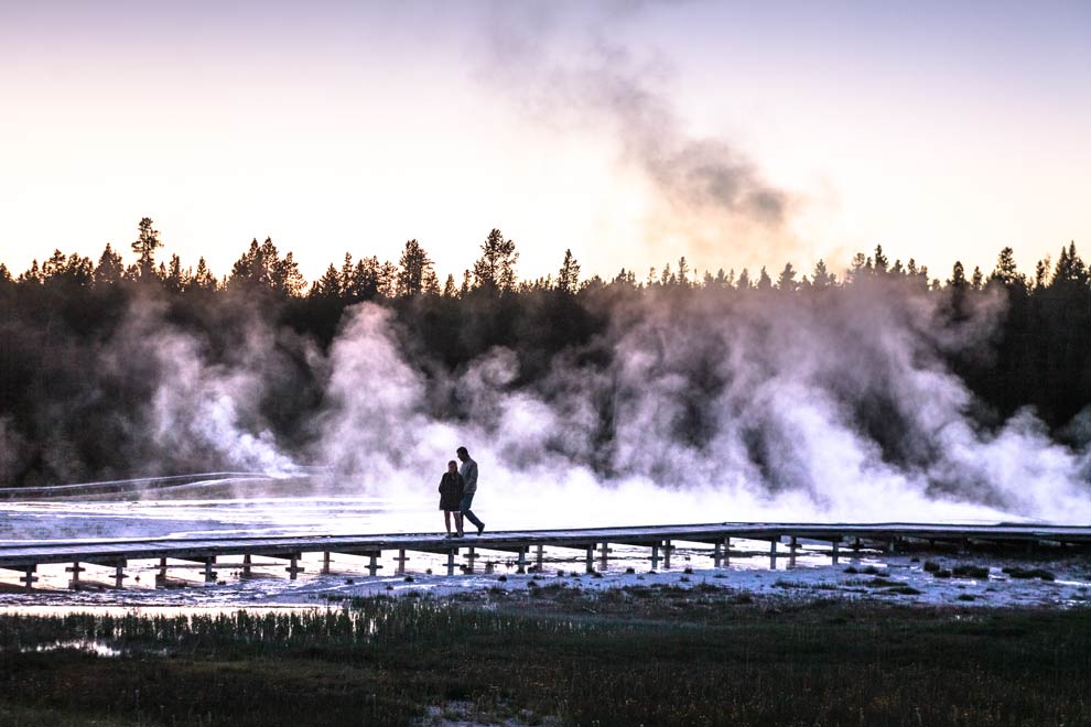
Icefields Parkway
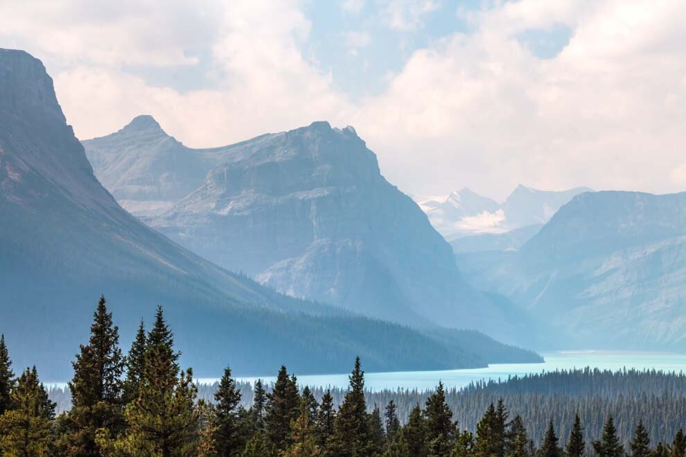
Most of my time was spent driving up and down the Icefields Parkway, and really, that alone is a spectacular attraction. The environment ranges from crazy glacier passes, to mountains abloom with purple flowers, and gobs of delicious glacier fed rivers and lakes.


Some serious glaciers!

There are plenty of different colored flowers along the way…

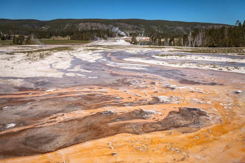
Peyto Lake
OK, technically, this is in Banff National Park. If you read my Banff blog, you may remember me opting to put it in my Jasper post because the short walk to see this view is on the Icefields Parkway, so I’m including it here.
If I remember, there is a decent walk to get to this vista, and it was very crowded. Definitely a hot spot!

More blue Gatorade! DELICIOUS!

Coleman Creek
This is some random spot I pulled over to take a walk and check out the river.

The color was fascinating…Gatorade needs to make a drink this color…

Back on the Icefields Parkway….

Drove through this area a couple times and pulled over to walk around and admire the views. Each time it did not disappoint!


Come on now…Canada…

Some rich reds, and magenta or violet flowers seemed plentiful in this area:

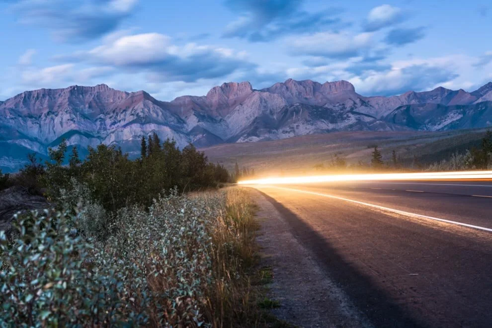
Ahhh when the sun goes down, the colors just get sooo cool!


After dinner, I decided to head back on the road and check out the scenery around sunset.

Pulled over in some spot for reflection photos:


And why not some long exposures on the Icefields!?

The next morning, I was back on the road, nice and early. This may be my favorite snap of the day:


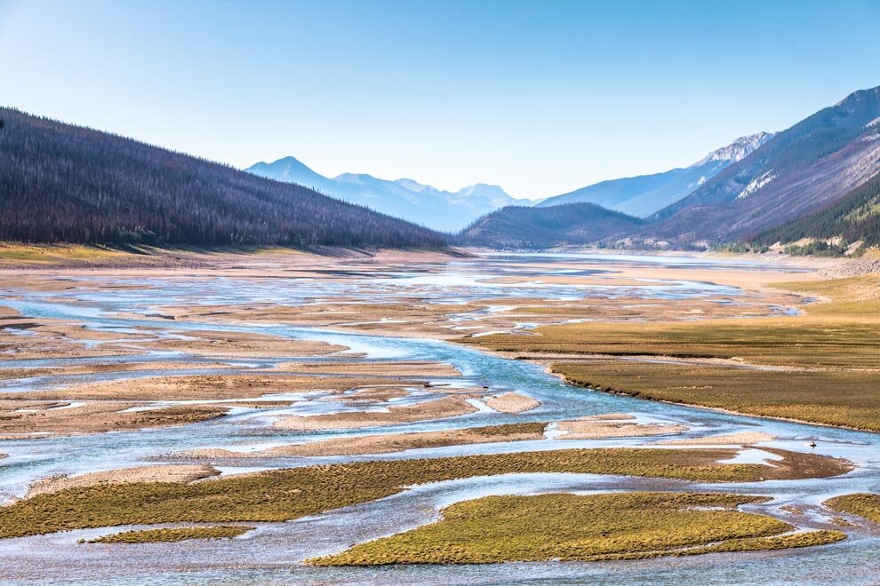
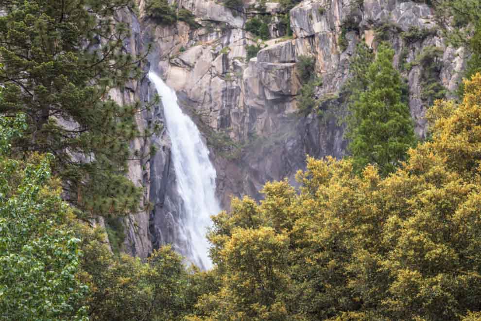
Sunwapta Falls
When I stopped at Sunwapta Falls, I had some time on my hands. I decided to go for a little trail run along the river trail. Felt so good to get out and stretch the legs! Beautiful area.


More views from the river side:

Maligne Lake Scenic Drive
Ok, my final destination was good ole Maligne Lake. Maligne Lake is the largest natural lake in the Canadian Rockies. It gets a ton of hype and may be the most quintessential spot in Jasper.
The Scenic Drive to get there is really cool also!


And, I finally arrived…
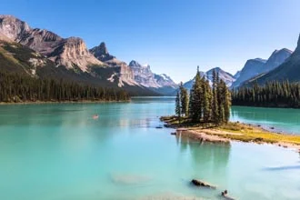
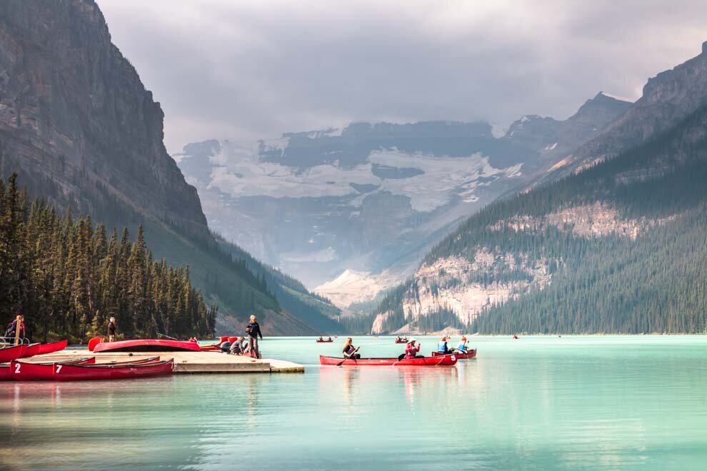
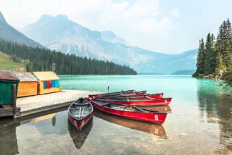
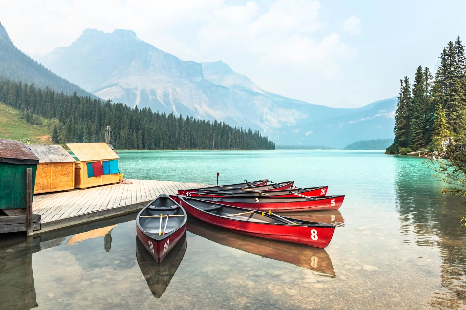
Maligne Lake


Maligne Lake has such a rich turquoise color!

Maligne Lake Cruise to Spirit Island
This is the tourist upsell spot, but I did not even hesitate. I wanted on that boat ASAP!

Get me out onto those turquoise waters and I gotta see Spirit Island.

I got lucky with a really cool tour guide, and I completely forget their name. They filled in nice little info about the lake, and answered our questions about Spirit Island.


Spirit Island
Arriving at Spirit Island was super cool, a spiritual experience! Naw, I’m messing, but it was a beaut. And we got to walk by ourselves for a while on a nice little trail with various views of the iconic feature.

Like everyone else, I took a gazillion snaps…


My last night in Jasper was a bit sad—the end of the road trip! So, I took my time, slow and steadiy made my way back down the Icefields.


I’ll be back some day I said!

And that concludes my 3 part series on the Canadian Rockies!!!
If I was forced to rank these 3 Canadian Rockies National Parks: Yoho, Banff and Jasper, I would have to go:
But they all have such unique charm! LOVED THEM ALL!
I would love to visit again during wintertime.
Would love to do some boarding…
maybe hit up Whistler!?
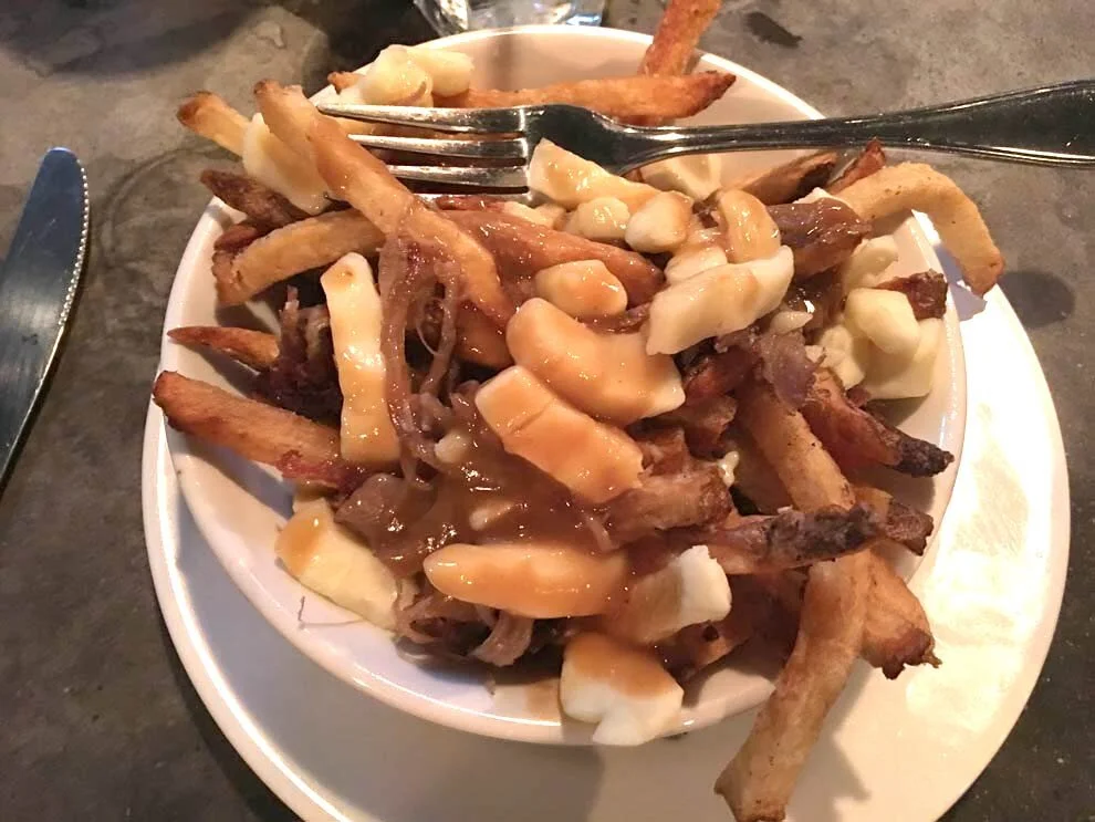
And, who am I kiddin’, I just want some o that POU-TIINE!!!
Here’s a couple other random Canadian snaps from the road:


What do YOU think of the Canadian Rockies!?
Leave a comment below!
Canadian Rockies Pt 2: Banff National Park
Ne’er has there been a national park with a cooler name. Big & Bold and FUN. I can’t help but say it with an explosive sound at the end!
BANFF!!!
Here is the 2nd in this 3 part series about my 2017 road trip in the Canadian Rockies!

BANFF!!!
Ne’er has there been a national park with a cooler name, IMO. Big & Bold and FUN. I can’t help but say it with an explosive sound at the end!
BANFF!
And the park itself lives up to the name in so many ways. It was probably my favorite of the 3 I visited (w/Yoho, Jasper), most likely because it boasts so many big and beautiful features.
I spent the most time on my Rockies road trip in Banff. And I feel like I barely scratched the surface.
On my way out of Yoho National Park I stopped in Field to get a snack and a snap:

Banff National Park
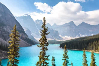
If you know of Banff, I imagine you saw pics of their 2 most popular lakes: Moraine Lake

…or Lake Louise.

I first peeped these spots on Instagram a few years back.
“I want to go to there…”, I thought (salivating like Liz Lemon).
Both lakes feature stunningly colorful glacier-fed crystal blue water.
All I could think of was…Gatorade!
Lake Louise
I visited LL both at sunset, and in the morning. I did the typical tourist thing…went to the selfie spots.
Around sunset, the sun rays were emanating on to the lake…majestic.
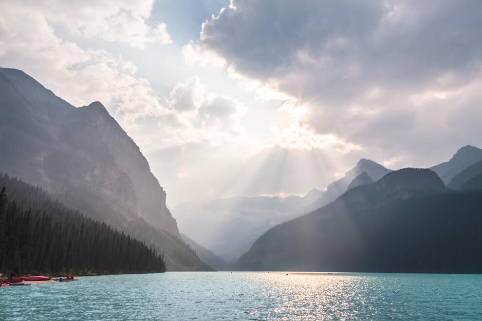

Majestic!
But all of that bright backlit sun made it difficult to realize the true color of the water.

Returning in the morning, the light was waaay better.
But, my solo posing game was still suspect.

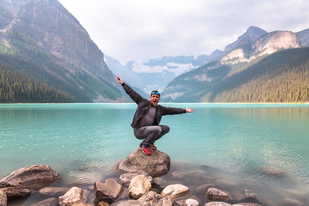
This next one is not bad as it looks a bit like I’m falling into the lake!

Simple selfie, maybe better:

It just looks delicious doesn’t it!?

Reminds me of Gatorade!
Moraine Lake
First, I arrived at Moraine Lake also around sunset and…WOW. The deep turquoise colors do not seem real!


During the day, the water color is a mix between Cool Blue and Glacier Freeze Gatorade I think…

Ok, this next video is not even remotely factual, but when you’re traveling alone you get some funny thoughts…
After spending some time in Moraine Lake and Lake Louise, I wanted to do some trekking. Heard about Hector Lake, which seemed like a healthy hike.
On the way, I pulled over to check out this smaller lake, I believe this is Herbert Lake. Quite cute for a picnic:

Hiking to Hector Lake
Saw a sign for the trek to Hector Lake, and Hector Lake looked gorgeous, so I ventured on to the trail..


Alongside some beautiful rivers…


But, the reality was, I did not have a map. I lost the trail after crossing the river and I had to bail. Wish there were other hikers around to point me in the right direction!
While I did not make it TO Hector, I was able to see it from afar:
Back on the road!
So much to see, so little time!
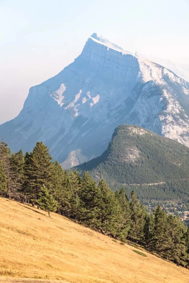
Mount Norquay
I need to come back here to snowboard, cuz Mount Norway features some absolutely stunning views of Banff! And these are just taken from off the road up to the mountain, I can imagine how gorgeous the views are from the peak!


Pretty romantic spot.


I barely spent any time in the Town of Banff, would love to do some night photography here.

Vermillion Lakes
As far as photography goes, this is a GEM. I was here mid day, but I drool over snaps from Vermillion at sunset or sunsrise. It’s just extraordinary!


Loads of different flora to put in the foreground. See the smoky sky from the forest fires a little bit.

Random snaps from the road when the moment felt right…


Oh come on, OK i’ll pull over and have a look…

Sunshine Valley
Another ski resort, and this time I’m actually going to the top. Love a good gondola ride. Just the right amount of exhilaration to get you amped for the peak!


PEAKING.

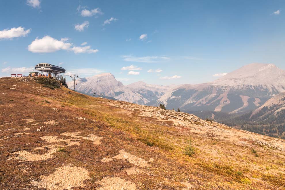
A short walk from the gondola, and this next view…

The smoke was intensely blowing in this direction, which made for a cool, creepy ominous tone…
Colors… everywhere…

Lots of smoke though…

Just down to the Mount Standiff chairlift, there are a couple trails and I chose the Meadow Park Trail
Trekking!
In gorgeous COLORS.
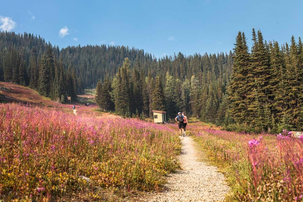

The views…


GIDDY POSING


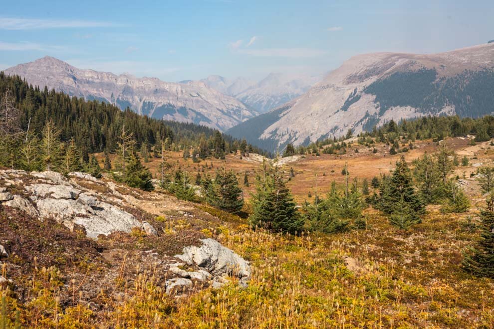
Coming back down the colors were even more rich!


After the hike, it was time to head back down…
Driving in the Rockies during sunset is one of my favorite things to do!


Peyto Lake
OK, technically Peyto Lake is in Banff, BUT, because:
1) this is already super long…
2) Peyto Lake scenic view is on the Icefields Parkway, which I associate a bit more with Jasper…
3) I did not spend AS Much time in Jasper and don’t have as much to share!
Saving Peyto for the next blog…
All right, that pretty much wraps up my blog about Banff! Thank you SO much for scrolling (I mean, reading) down all this way!
What did YOU think of Banff!?
What did I miss!?!?
NEXT UP: The last in this 3 part series:
Jasper National Park!
Canadian Rockies Pt 1: Yoho National Park
In 2017, I embarked on a 2 week road trip in the Canadian Rockies, visiting 3 National Parks and driving through a couple more on the way. This is the 1st of a 3 part series, starting with Yoho National Park!
After this, Banff National Park and Jasper National Park! Coming soon…

In 2017, I went to Vancouver for the first time to watch the World Championship of Public Speaking live!
BTW, Vancouver is an incredible city!
I could see myself living there because I love coastal cities and it’s so close to some amazing mountains!
Rockies Road Trip!
After Vancouver, I head east to begin my road trip through some of the Canadian Rockies — which are HUGE.
When I set out to visit the Canadian Rockies, I didn’t even realize it was the 150th birthday of Canada and all national parks were free for the year! YEAH BABY!!!
On the way to the Rockies, I pulled over at this “beach”, Rutherford Beach which is right outside of Revelstoke. My timing was on point and the views were fantastic!

I should mention that during this trip there were some pretty heavy wildfires raging in the Canadian mountains. This is normal for the mountains during this time and sometimes it created an interesting ambience of warm colors in the sky. But most of the time it just meant that the visibility was crappy and the sky was tainted. Here you can see the warm tones up in the smoky sky.

Revelstoke seemed like a cool little town, maybe better in the winter when you can hit the slopes!

Yoho National Park
First blog will be about Yoho National Park. There are lots of gorgeous sites and things to do in Yoho, and below is just a sample. I think I spent 3 days there, which is really not enough.
I stayed in the small town of Golden, the Gateway to the Western Canadian Rockies and drove into Yoho each day. Golden was a great spot to post up. One note about the Rockies, is that almost all hotels and lodging are expensive. You are paying national park touristy prices. Golden had a hostel which I believe was about $50 USD per night for a bed in a dorm. I didn’t have all my camping gear, so I needed a hostel.
And, Golden had some incredible poutine! If you like cheese and fries…you need to try poutine. I ate a LOT of poutine on this trip. :P

One of the first places I stopped was Emerald Lake, a gem indeed!


I would have loved to spend more time here and see a sunset or a sunrise, but I had so much to see! Next time…


My solo posing skills are sub-par but I do my best. Nice remote clicker in my left hand.

Leaving Emerald Lake, heading back toward the vacation town of Field, British Columbia in Yoho National Park.
A small lake in the town of Field:

And this is the view in the opposite direction…fascinating colors especially the water juxtaposed against the warm color smoky sky:

When I was in this location, I decided to make a video about my newfound Canadian accent.
Ok, so maybe I didn’t really pick up a Canadian accent but I did find myself pronouncing words differently and picking up the local phrases.
I just recently realized that this accent video has over 200 views on Youtube. Super random, and I’m surprised the video hasn’t gotten troll comments!


Faeder Lake
In the Canadian Rockies, there are some huge glacier fed lakes and then there are some little lakes like this: Faeder Lake. You could almost call it pond cuz it’s so small. There are some picnic tables, a parking lot and then this cute lil cozy spot! Loved it.
I ended up stopping at Faeder Lake almost every day before returning to Golden, because it was so peaceful. Especially when the sun is going down!


One of the nights I ran into these two car-camping, bear-seeking gals from Denmark, Sophie and Julie. They were nice enough to share the lake with me, and we had a great time chatting! We ended up meeting up one more time a few days later up in Jasper National Park. They were so amped to try and see some bears and I personally was so amped NOT to see any bears. I gave them my bear spray as a nice parting gift. Thankfully, they did not have to use it.

After leaving Faeder Lake, I had to pull over for these colors!


Takakkaw Falls
What’s a mountainous national park without some waterfalls, eh?! Takakkaw Falls is a nice short walk from the parking lot and well worth the stop.

I love how every stream, lake, river, pond, etc has its own unique color scheme! Takakkaw is sweet.
And you know the ole saying from the sea: “where there are waterfalls, there are usually rainbows!”
That’s a saying, right?

The road to exit Takakkaw is a view of Yoho Valley. I absolutely love driving in mountain scenes like this! EPIC.

There is a lot more to see in Yoho, so I will have to go back sometime. Lake O’ Hara seems really nice and Wapta Falls also.
NEXT TIME.
Overall, Yoho is gorgeous YOOO!!!
Next up, Part 2: Banff National Park!
Coming soon…
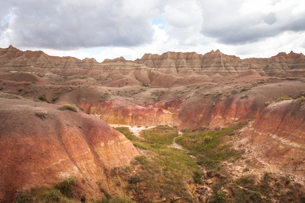
South Dakota and the Bad Ass Badlands
I had no idea what to expect from South Dakota, but the state really surprised me! This blog should probably be called 'West South Dakota’, because, I only really stopped in the western part of the state, which I think is certainly more picturesque! I spent time in both the Badlands National Park, and Mount Rushmore.
See more snaps and a review of the experience!

I had no idea what to expect from South Dakota, but the state really surprised me!
(Sorry SouthDakotaCJ, I should have known how good it would be from your IG!)
I left my friends in Louisville CO, which is a fine town in Boulder, BTW!
Actually, it got voted “2nd Best Place to live in America” recently. It features this dog / people park the Davidson Mesa, which is where this sunset video comes from.
Nice big park, big time dog-friendly! Great neighborhoods!
This blog should probably be called 'West South Dakota’, because, I only really stopped in the western part of the state, and just drove straight through the east.
The West is certainly much more picturesque! I spent some time both in the Badlands National Park, and Mount Rushmore!

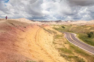
Badlands National Park features these iconic rolling hills
BTW, if you want the ULTIMATE Guide to the Badlands National Park, the folks at 10Adventures.com have an incredibly detailed website and gobs of info about it here. Free to download route maps, with reliable GPS coordinates and much more info.
Mount Rushmore is set in the Black Hills National Park.

I arrived at Mount Rushmore kinda late, but got there just in time to set up my tripod and see sun down and the ceremonial pre-show they put on before the nightly lighting of the Monument.

The scene is pretty epic!

First, a Black Hills National Park Ranger starts the show with a warm welcoming speech.
He told a touching story about the history of the park and the creation of the monument, which is a little bit…let’s just say…complicated. Read more here and more here.
After the initial welcoming speech, they played a ~35 min video tribute to the 4 men featured on the famous monument:
George Washington
Thomas Jefferson
Abraham Lincoln
Theodore Roosevelt
Legends!

The cinematic video was well done!
A great history refresher featuring stories about each man. The show is loaded with tons o pomp and circumstance, good ole Americana values and and just the right touch of cheesiness!
And then…they lit the monument!
“Ahhhhhhhh….oooooohhhhh….wooooooowwwww….”

I felt this incredible sense of pride for my country when I visited this monument. So much that I felt I needed to invest in a souvenir t-shirt:

Ok time to go.
Here is the scene looking back from the main entrance.

Driving out of Mount Rushmore, we had some tough traffic, but it gave me a chance to snap this side view of George Washington.
Nice posed profile pic Georgie! Sign him up for an Instagram!

The next day, I headed west toward Badlands National Park!
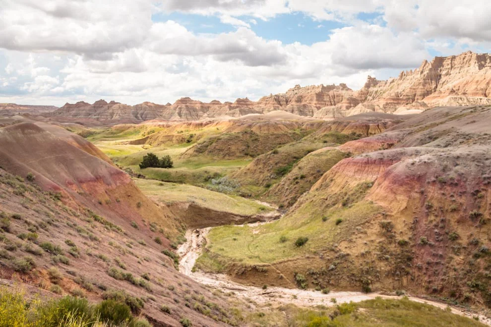
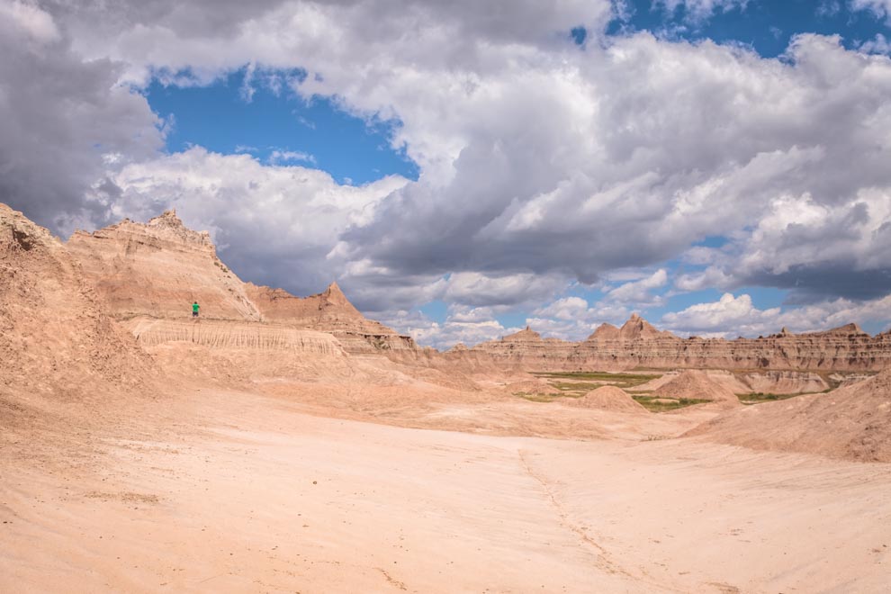
I basically just took an afternoon to drive the Badlands Loop Road (Highway 240), which takes a couple hours and features plenty of scenic vistas, and stopping points.
I had no idea what to expect about the Badlands but I was big time impressed! Super cool rock features, super unique coloring on the mountainous terrain and just overall weird! (In a wicked awesome way)

Where’s Wildlife?
Get after the view player, I got your back! 100 Insta Likes right there.

Boy vs Goat Standoff!

The vast landscape is quite nice all over the park!

A fellow park visitor asked me to take a snap of him, and I agreed to send it to him.

I sent it through email, but I don’t think he ever responded. Not surprised.
It’s cool, I ain’t mad at ya, Badlands Guy.
The Park was cast in a decent amount of clouds that day creating some sweet mood.

Glad I had my wide lens for some if these vast long shots!


Fascinating colors…
Would be a blast to do some longer hiking around here!
“Hey guys, come here check out this view!”

The coloring in these hills is so unique and cool! For more info about it and free downloadable hiking routes, 10adventures.com has tons of info!


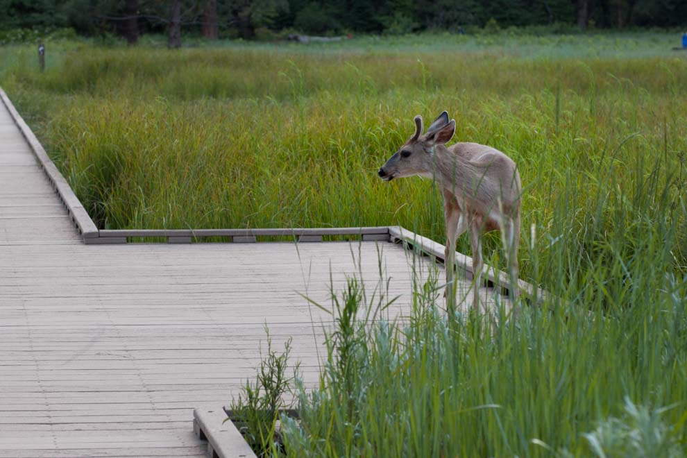
If you look close, you’ll see a bunch of lounging mule deer, maybe? Maybe pronghorns!?


Hmmm, looks like it’s about to rain…


STORM WATCH!

Then, it cleared up.
Watch out for rattlesnakes!


I really only drove through the Badlands National Park for a few hours, but it was a total blast!
Every National Park has its own style, aesthetic and flavor.
A goal of mine is to visit ALL the US National Parks someday.
I highly recommend visiting the Badlands National Park.
And I can’t say enough good things about the Mount Rushmore experience!
Visit South Dakota!
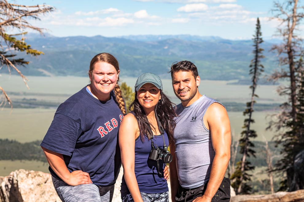
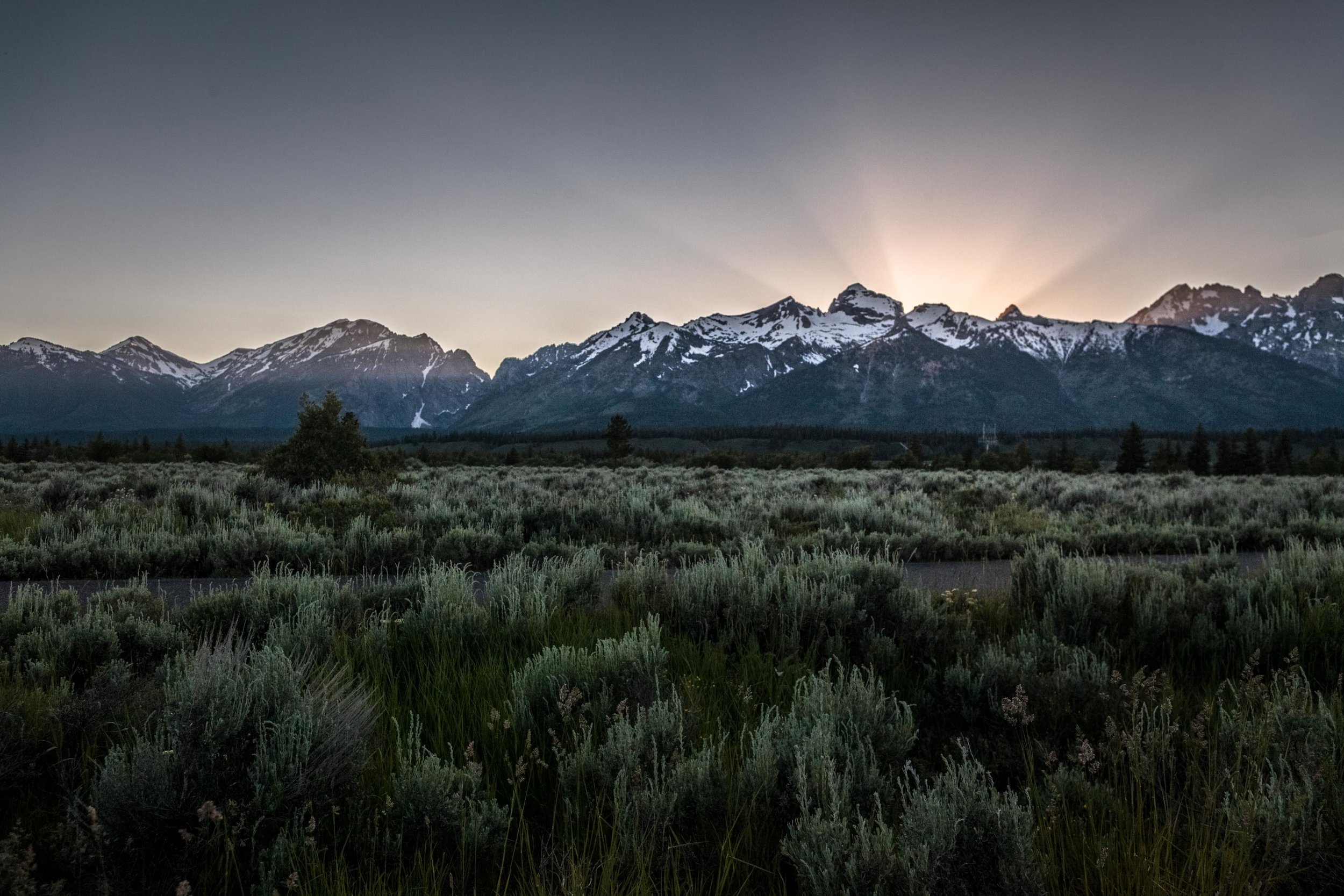
Grand Teton & Delta Lake
If you visit Yellowstone, don't ignore the Grand Teton! Read on for the story of how I came face to face with a bear and survived!

Grand Teton National Park, Wyoming.
If you visit Yellowstone, why not throw in the Teton?! If you drive south and exit Yellowstone, you're entering the Grand Teton park. And, it is indeed grand.


The Tetons, as they are commonly referred to, are much different than Yellowstone. They feature the Teton mountain range (~4000 m), which is omnipresent throughout your experience in the park.

Most of my time in the park was on the east side of the Teton range, which meant that the sun was setting behind the range. The result are these majestic, sharp backlit mountains that seem to glow in the evening.

Before I left for the Tetons, I asked a Yellowstonian what I should see and do in their Tetonic neighbor. She highly recommended taking a walk around Jenny Lake.

Jenny Lake is a gorgeous little body of water nestled just in the valley of the Tetons. A lot of campers come and camp out along the edge of the lake. Hammock abound. And, the views are stunning. Unfortunately, the lake water levels were a bit high, which obfuscated the path around the lake. Yes, I did just use the word obfuscate.

But, I met a local gal who was hangin' in a hammock and we got to chattin'.
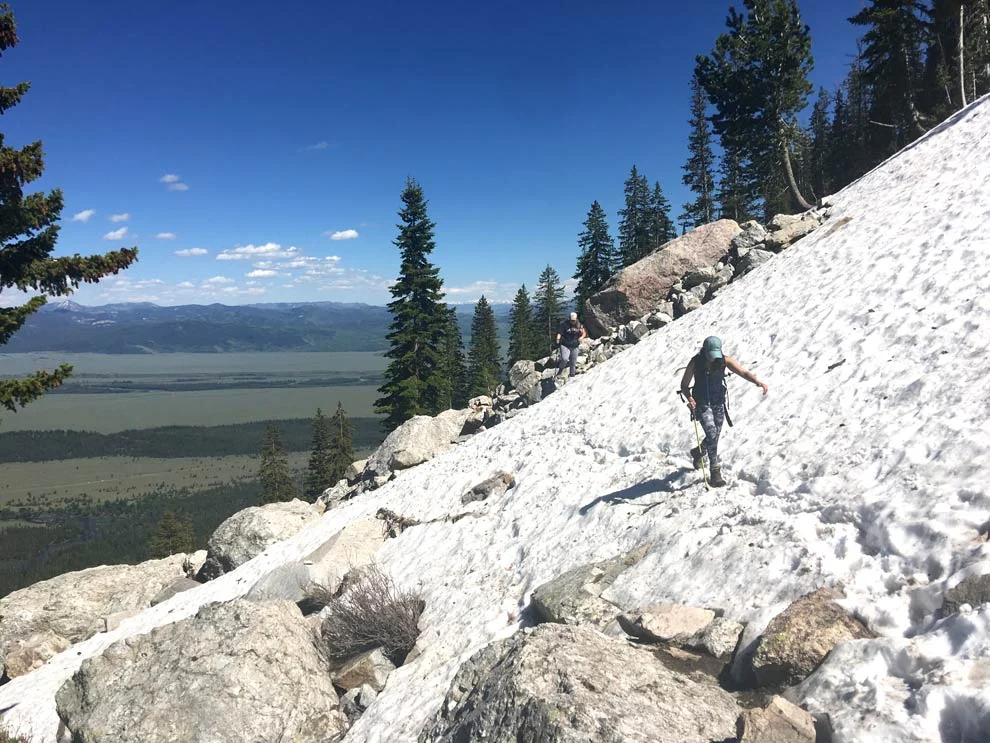
Told her I had ~2 days to play with, and she recommended I hike the Delta Lake Trail. It takes about 3 hours to get up to the top, but apparently, the view of this emerald green Delta Lake is worth the difficult and lengthy trek.
She also warned of serious bear action on that trail.
You can't go anywhere around these national parks without hearing about bear safety. And, at a certain point, you think, "Well maybe I should stop and listen to this action?"
Knowing I was going to hike alone, I decided to invest in some bear spray. Bear spray is like high powered pepper spray, shoots up to 30 feet. Maybe saves your life.
Next up, I stopped at the National Park Visitor Center to see if they had any updates about the Delta Lake Trail.
Also, met the moose outside.

When I told the worker I planned on doing the Delta Lake hike, she went from playful, positive happy-go-lucky government worker --- to concerned & cautious parent.
I guess she trekked it a few days before and there were some slippery spots near the top.
"Oh, ok, that's good to know. I also heard there are bears up there, so I bought bear spray."
She looked me in the eyes and said, "Oh, bears are probably the least of your worry."
She went on to tell the story of a girl who was trekking earlier in the week, and stepped on a snowy patch, only to realize the snow was just covering up a shallow crevasse. She stepped into the crevasse and a stick impaled her calf. 30 stitches.
Ok, I get it. it's a tough trek.
But, I'm still gonna send it!
Halfway up the trail, the weather is gorgeous, the views are great. No bears yet.
Met some nice trekkers from Canada. And then, 90% up the trail, I run into these 3 Bostonian hikers. I'm from the Boston area too! Serendipity.
Andrew, Ana and Alice---I later dubbed them the "A team". Or, "Triple A".
It was nice to have a crew to summit with, especially so close to the top and especially when the trail gets a little dodgy. Here is Ana and Alice crossing this avalanche-y area which I felt a little uneasy on.
And, YUP. We made it! The reward: Delta Lake.

I wish I had gone a little earlier in the day, because the sun was setting right behind the range, and affected my snaps. If you're goin' for the high quality snaps, check where the sun will be on PhotoPills first.


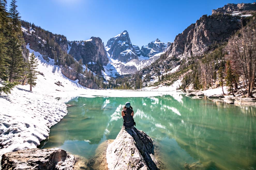

It was already getting late and it was gonna take a couple hours to get back down, so we didn't spend much time at the top, even though we all wanted to.
This was one of the better hikes I've done in my life and truly satisfying to reach the top! The adrenaline was flowin' for all of us as we headed back down.

We were hootin' n hollerin' n yuckin' it up nice. The A-Team was awesome and I was super glad I met them and got to share the experience with them!
Also, we were stoked we didn't see any bear action!
We traded stories about recent run ins with wildlife. I shared my story of seeing the mama griz and her two cubs at Yellowstone 2 days before.
And, the A-Team shared their story of how they were surrounded by bison TWICE on a Yellowstone trail days before!!!
We talked about how we had no idea how we would react if we did indeed run into a bear.

And, then we turn a sharp corner and Andrew says, "Guys, there's a bear right there...and we need to keep moving."
JYNXED OURSELVES.
WE RAN INTO A BEAR.
10 YARDS AWAY.
Here's a full video description of the experience, OR continue reading.
The bear was no more than 10 yards away. A black bear. As soon as I see it, it sees us. And, stands up at attention.
Andrew is in front, then Ana, then Alice then me bringing up the rear. The first thought that went through my head was, that we should actually retreat and put distance between ourselves and the bear. But that's because I was in back. And, going forward meant that I was actually cutting the distance between me and the bear!
Second thought that came to mind was, "I should take a photo." I had my camera hangin' off my neck, and thought, this would be an epic National Geographic snap that will put me on the map!
My third thought was, "NOOO, this will be the last photo I ever take."
And, my next thought was, "Oh, Alice has her bear spray out. Oh yea...bear spray."
It is incredible how quickly thoughts race through your mind in a traumatic experience. It all happens so fast, yet time seems to stand still.
And then, "Don't make eye contact. No sudden movement. Talk a little bit..."
Seconds after pulling out the bear spray, I realized my legs were very shaky. Everything else felt ok, but I was a little jelly-legged as I continued to walk.
3 out of 4 of us had bear spray. And, petite Ana had a knife. Which is slightly funny in hindsight.
Thankfully, the bear did NOT charge. It was probably eating some berries and simply let us walk by.
Maybe if I was alone, I might have been viewed as prey. But, there's strength in numbers when it comes to bears in the wilderness.
We still had about ~1 hour to get back down and the rest of the way was giddy! We were all freaked out and tried to joke as much as possible. While nervously scanning our surroundings like paranoid fiends.
Thankfully, no more bear action. We made it down. What an incredible experience! What a day.
Ohhh, Delta Lake, you!!! You gave us the thrill of a lifetime! And, thank you for being kind.

My thoughts in the immediate aftermath:
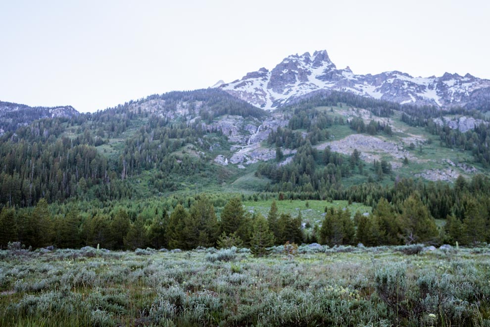
Sadly, I had to part ways with the A-Team. They were heading to West Yellowstone and I was heading to Jackson Hole. And, driving out, I was lucky to see some non threatening wildlife.


And, stopped to admire the heavenly glow behind the Teton range.
And, back to Jackson, which rivals West Yellowstone in its charm and design!

All in all, an epic adventure in Wyoming, which now ranks up there in my list of most underrated U.S. States. Do yourself a favor and book a trip to Yellowstone and Grand Teton. I know you will not be disappointed!
Yellowstone (Not Jellystone) National Park
Yellowstone, not Jellystone. Definitely different than Yogi Bear's top place to picnic. The world's first National Park, A UNESCO World Heritage site, and one of the weirdest places I've seen on Earth. In a word: otherworldly!

Yellowstone, not Jellystone. Definitely different than Yogi Bear's top place to picnic.
It's a UNESCO World Heritage site, and one of the weirdest places on Earth. Truly otherworldly!
Yellowstone National Park is noted as the world's first National Park (although the folks up in Yosemite would beg to differ). It spans across 3 states (Idaho, Montana and Wyoming), with the vast majority in Wyoming.
It really is unlike any place I've visited. Remember science class? I know it was a while ago, so let me school you.
Volcanos. Deep below volcanos, you find this wicked hot stuff called magma that exists in this big underground chamber. Yellowstone is home to a wicked big 'supervolcano'. This wicked big volcano had a wicked big magma chamber. Think of a cave under the Earth's crust, "about 37 miles (60 km) long, 18 miles (29 km) wide, and 3 to 7 miles (5 to 12 km) deep".
In this chamber is water.
Magma is so hot it heats the water.
Water boils.
Creates steam.
Sometimes gets so hot and steamy it needs to escape.
Kinda like a teapot.
Creates holes in the Earth.
These holes are geysers. (Remember them?)
Or steamholes.
Or, they create thermal pools.
Or, hot springs.
Scientists and geologists could give you a lot more info. But, that's the gist. Get it? Got it? Good.
Enough science. Let's just look at some of this madness!

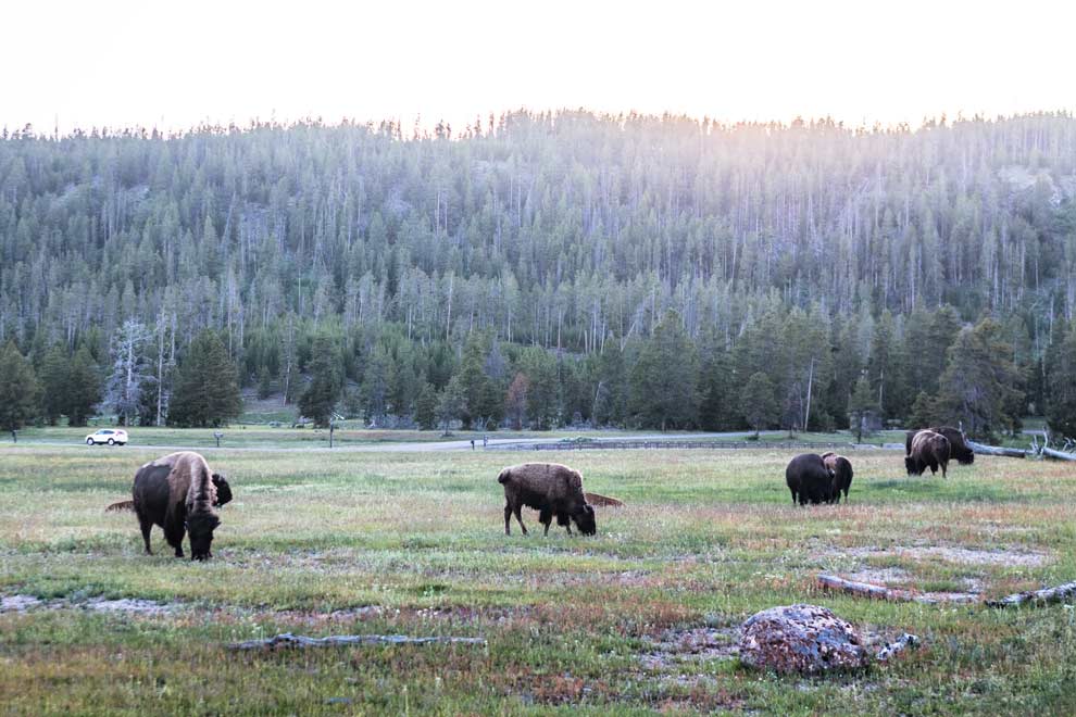
Tons of wildlife in Yellowstone: Bison, Elk, Bears, Coyotes, Badgers, Moose, etc.
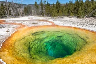
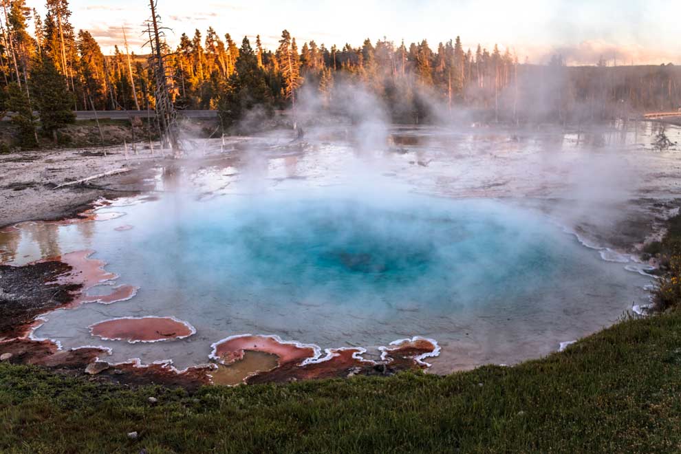
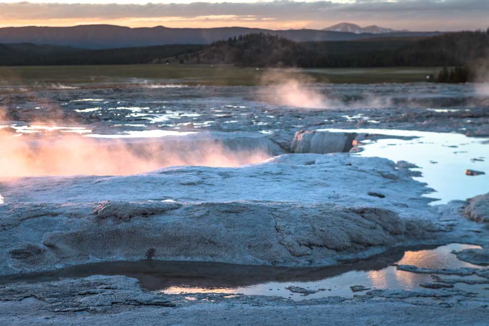
First place I visited was the Lower Basin. They call this the "ghost forest" cuz the trees have been killed by the geothermal features (hot springs are super salty and toxic, and btw, it smells like rotten eggs in a lot of these basins):


Looks like you could swim in this nice hot spring, right? WRONG. Death.


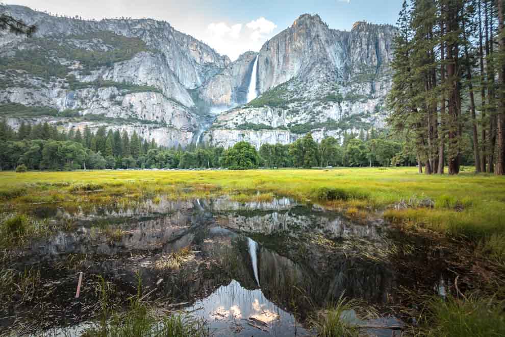
Really? Did you think I was going to blog about a national park and NOT include a waterfall?

I loved the Lower Basin, especially at sunset, but the Norris Basin was really otherworldly! Almost reminiscent of the Salt Flats in Bolivia.


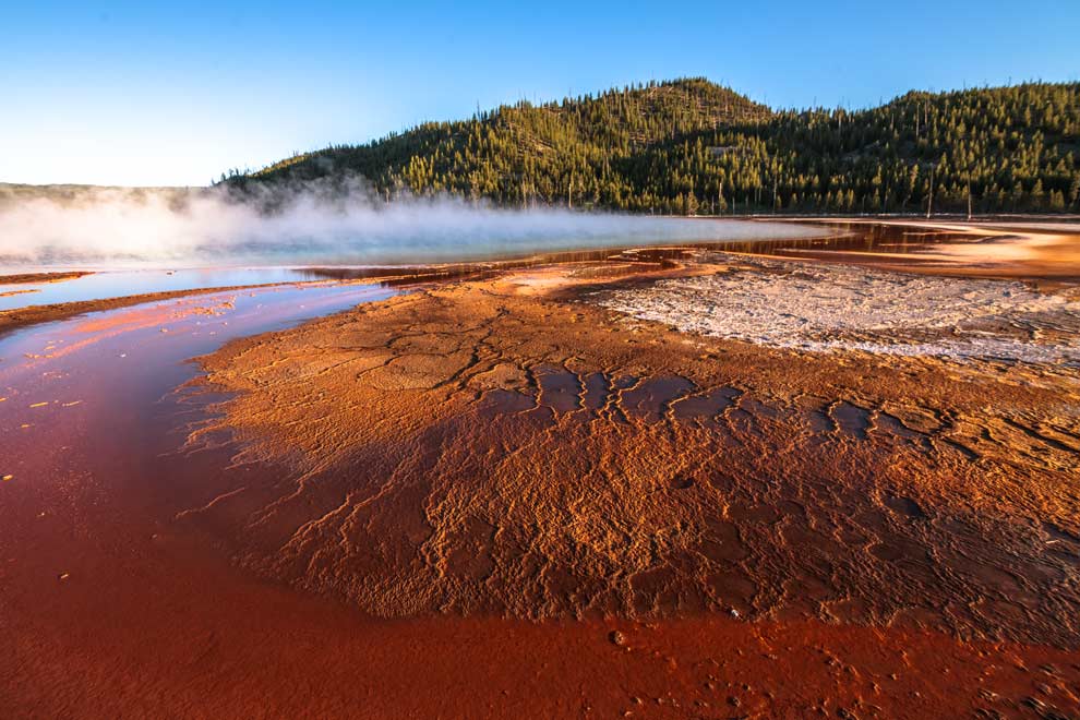
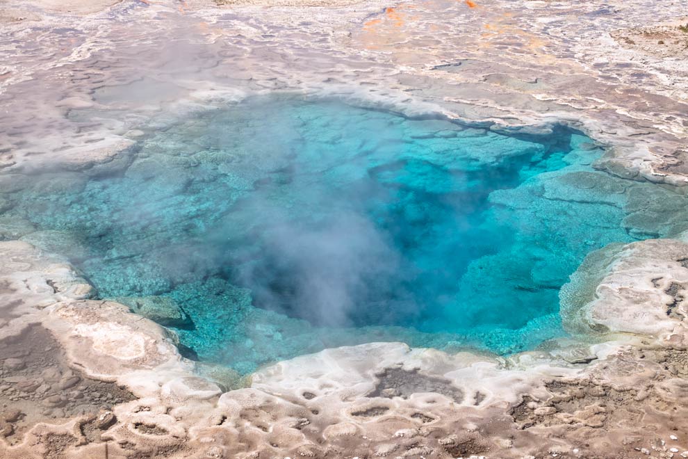
I stopped briefly at the Midway Geyser Basin...huge cavernous pools, and some incredibly shallow pools featuring floors that look like stepped slate or something.

In the big pool, there was this weird phenomena where I saw a rainbow circle around my head in the steamy shadow of this pool. Can anyone science-splain this to me?

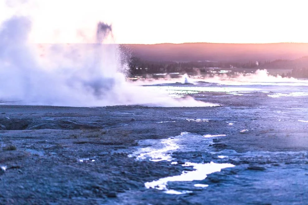
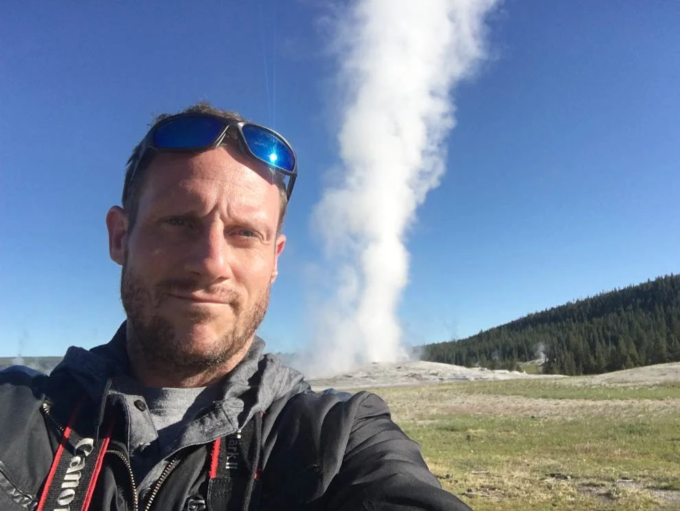
The Upper Basin is the main course for Yellowstone. Featuring everyone's favorite geyser: Old Faithful, which lives up to its name in every way. It used to erupt every ~30 mins or so, but after an earthquake years ago, it now is on a ~90 min schedule. Old Faithful's blowhole is only 4 inches wide.


Old Faithful gets so much love from park visitors, but the Upper Basin offers so much more than that! Again, I can't help but think this of this word: otherworldly.


Looks like a nice place for a dip, eh? (If you're into the whole sudden death thing)


This next snap shows the scale of some of these geysers. Granted, this one is slightly in the foreground compared to the people on the left, but not by that much. Some of these things are huge.

Just a coyote crossing the trail. "Don't mind me, just comin' through, doin' my scavenger thing."

Sentimental moment:
My last experience before I left Yellowstone involved a Grizzly Bear mama and 2 little cubs and a heroic effort by me. (Not really. But let's go with it, k?) Full story in the video below:

Yellowstone is now 2nd on my list of U.S. National Parks, behind the Grand Canyon!
GO BOOK YOUR TRIP.
NOW. I highly recommend checking out the travel experts and friends of mine at AllTheRooms.com, this crew has got you covered!
Wait, why are you waiting? :]
Next up: Grand Teton National Park and the story of how I came face to face with a black bear and cheated death!
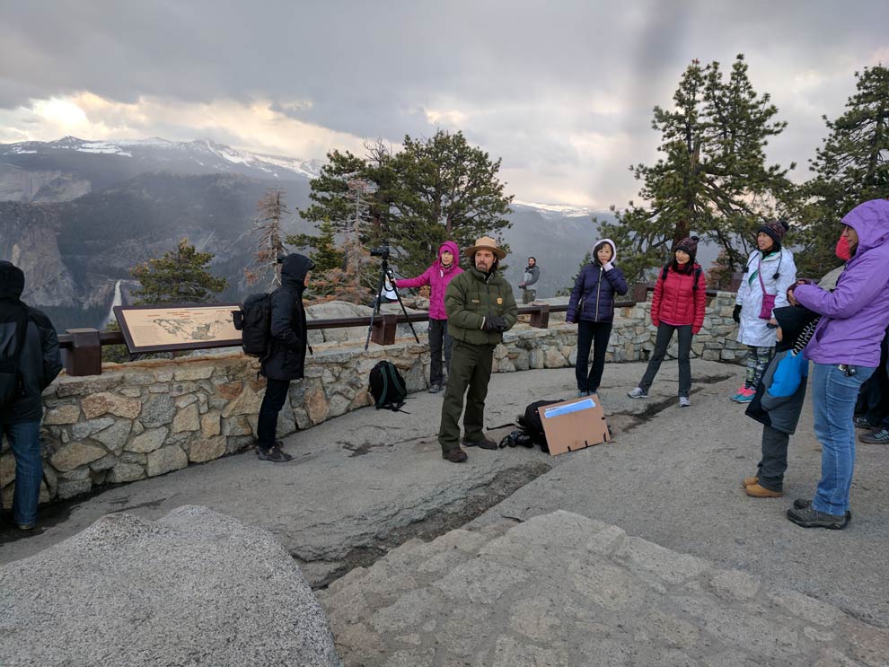
Yosemite Mountain Madness! - Day 2
After a tumultuous day 1 in Yosemite, Jay and I joked about how we could top it on day 2. Yeaaa, we may have jinxed ourselves...
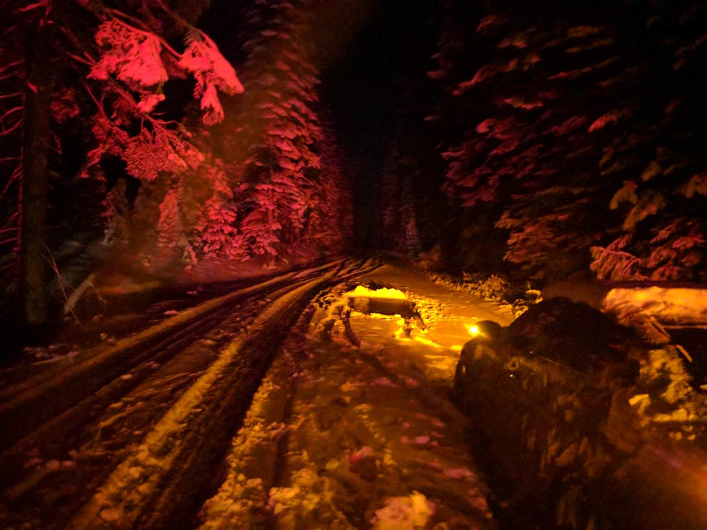
Day 2: Gettin' Down Glacier Point

After a tumultuous day 1 in Yosemite, (see day 1 blog here) Jay and I joked about how we could top it on day 2. Yeaaa, we may have jinxed ourselves...
Day 2: Gettin' Down Glacier Point
This next video tells the story of day 2 if you don't want to read. But definitely scroll down to see the pics and additional videos.
Since the adrenaline rush from day 1 had us up all night, we decided to sleep in on day 2 and have a late lunch before heading to the park in the late afternoon.
We stopped at the Visitor Center in Mariposa and decided we would drive up to Glacier Point, which is 7200 feet up, and has spectacular views of Yosemite Valley. The lady at the Visitor Center mentioned they got snow up in Glacier Point that morning but that the roads were completely fine.
Glacier Point is about an hour from Yosemite Valley and the road up is one of those white-knuckle narrow & winding mountain roads with a steep cliff on one side. A lot of the turns require 15 mph. But, along the way, there are many beautiful scenic overlooks and pullouts that we took full advantage of.
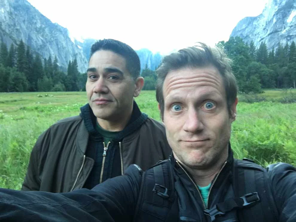
Sorry, Jay, but you take a selfie, you face the consequences.

One of the coolest stops on the road to Glacier Point, is the "Tunnel View". I thought they called it this because you can see through the valley, as if it's a tunnel. But, it's actually because the stop comes right before a tunnel. Ha! Maybe it has a dual meeting. Tunnel-esque, right?


After the tunnel, we pulled over a couple more times, cuz how could we not? Yosemite is breathtaking!

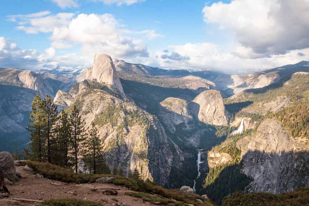
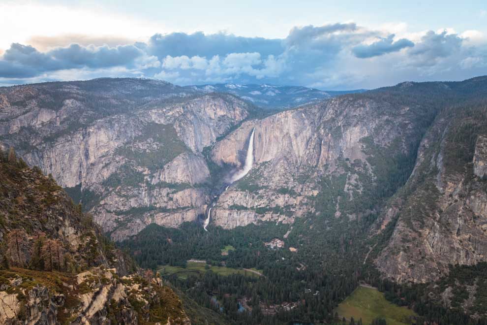
Washburn Point is very close to Glacier Point and although you can't see Yosemite Valley from it, it offers stunning views of Half Dome and some waterfalls.


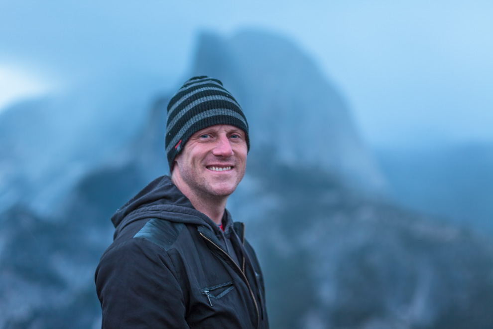
Finally, made it to the top! Glacier Point, baby!
The sun was just setting and the colors were coming in nice with all the clouds in the sky! It was pretty cold up there, and we realized it was flurrying!
This area is very much off limits, but dude had no problem dangling his dog out on the ledge. Cruel? Well, at least he got the photo and that's what really matters.

Every night on Glacier Point, a Park Ranger comes and gives a talk about the history of Yosemite and some of the interesting flora and fauna that live in the park. Interesting Fact: The only human death by animal in Yosemite was a deer, who sadly, impaled a child with its antlers as the kid was trying to pet and feed it.
If you read my Day 1 blog, you may recognize these next waterfalls, as the moonbow falls. And the green grass below the falls is where we took the pics of the moonbow and saw the deer.
And, Jay also pointed out, "Hey that's where I got lost!"
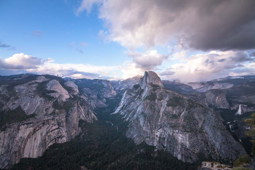
Oh, Half Dome, you had me at Half.


It started to get a little dark, and we figured it was time to bolt. Didn't want to do the white knuckle drive in the dark!
In the parking lot, Jay was amused by the fact that there were snow piles and he decided to make a solid snowball.
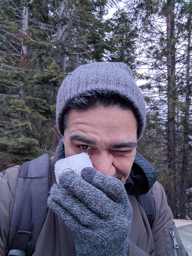
We set off driving back down Glacier Point Road...and the flurries started turning to bigger flurries. Jay recorded this video of us joking about getting caught in a whiteout. Yeaaa, we may have just jinxed ourselves again.
Sure enough, in 5 minutes, the flurries turned to hail! The hail turned to bigger hail and bigger snowballs! It was a complete whiteout.
Glacier Point Road is a white-knuckle drive sans snow. You add snow to the mix and it's like a death drive.
I was only going 15-25mph, and my car started fishtailing! I have a rear wheel drive Lexus and it is not meant for snow in any way shape or form. I righted the ship and continued on, slower...
And slower...
Fishtailing again...
YIKES!
Hmmm...this is scary.
Whoa...I think the sleet created a nice layer of ice below the snow that was accumulating with the quickness.
And, fishtailing again...
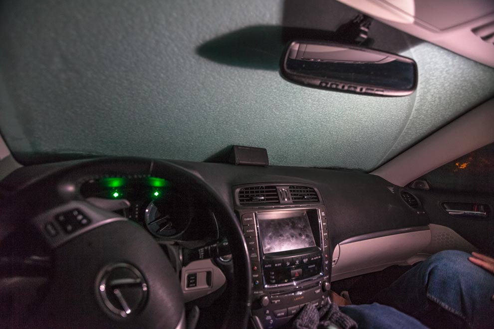
After the 3rd fishtail, I came to a stop on the hill. I tried to accelerate and my car just starts spinning with my rear sliding toward the cliff side!
STUCK.
On a hill.
Complete whiteout.
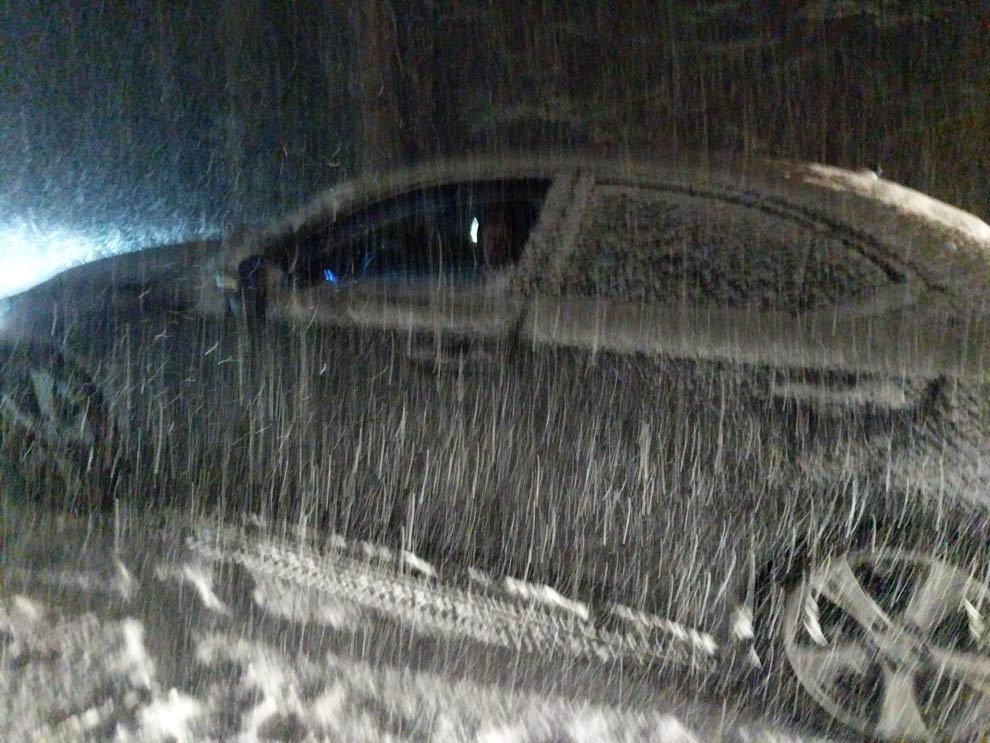
The car behind me was stuck too. And the car behind them and the car behind them. Some cars ended up in the ditch.
And within 15 minutes, our windshield was covered in snow. It was coming down HARD.
Looking back, I did notice there was an obvious storm on the horizon. But, I didnt' think twice about it. Never even considered that it would come our way.

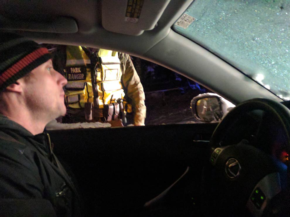
We settled in, with no clue how long we would be up there. There is NO cell service on Glacier Point Road. But, people with 4 wheel drive were able to drive down. And, we knew there was a Ranger that would have to come down at some point.
Thankfully, we had snacks bags, water, even a 5 hour energy drink that would come in handy later. We went into survival mode, rationing our snacks, occasionally turning on the car for heat. Broke out the leftover glow necklaces that I bought for #beachBonfireBash .

Not gonna lie, things got a little punchy!
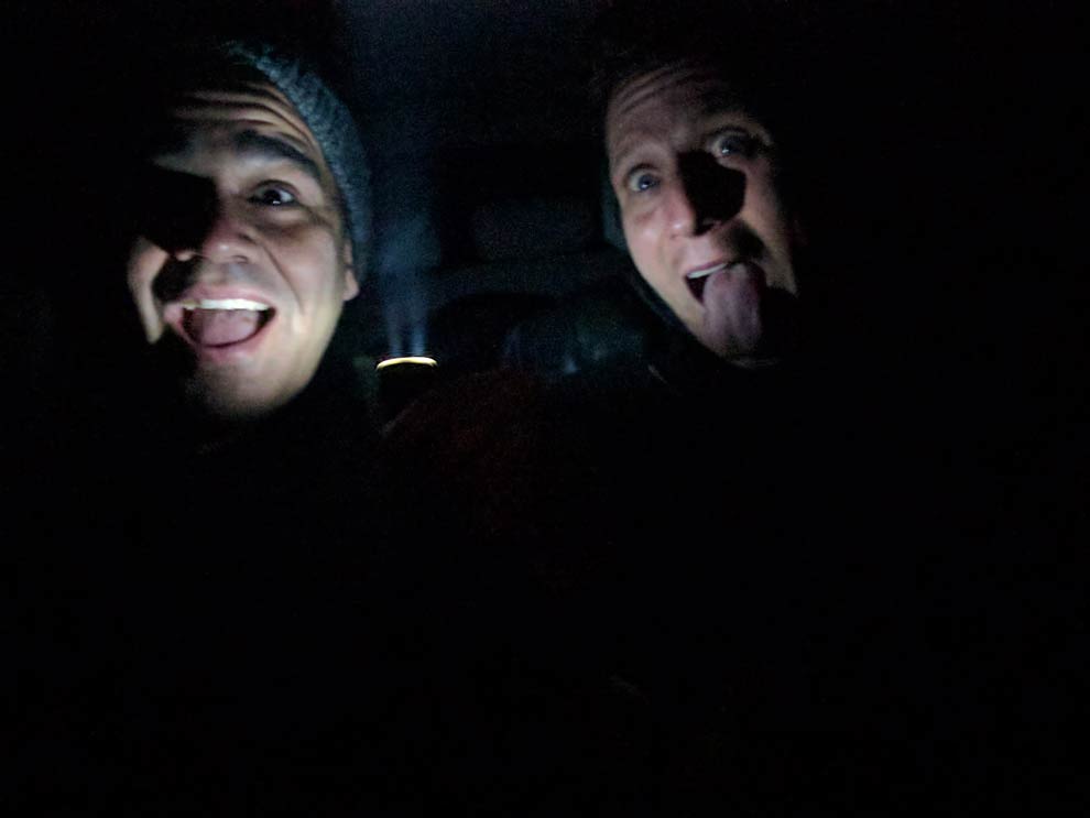
But, we were able to amuse ourselves with tunes, pass-n-play scrabble on my phone, and steppin' outside every now and again to check out the scene & talk to fellow strandees. (word?)
Hazard lights cast a cool color spectrum illuminating the dark road!
We got stuck around 8:45pm and had bets on when we would get down. Jay said 7am. I said 1am.
Thankfully, the Park Ranger came around 11:30pm and let us know that help was on the way! The plows were over an hour out, but at least they were coming. I think I won the bet.
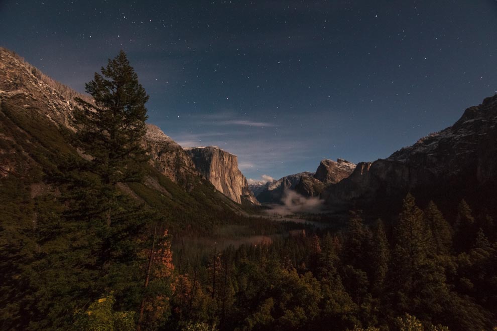
Once the snow stopped, the skies cleared and it was mighty nice out!


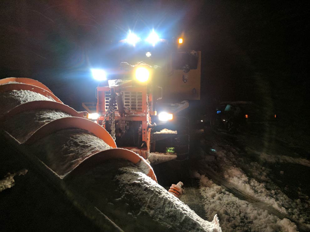
The plows came around 1am, and they started towing the cars that went into the ditch. And, they came and shoveled us out of our spot around 2am.
On the way back down the mountain, we stopped at Tunnel View, and I snapped this long exposure.
And, I couldn't help stopping for one more snap in a foggy moonlit meadow.
It took us ~2.5 hours to get back to our hotel. I was so nervous driving thinking everything was black ice! All in all, stuck at 8:45pm, got to the hotel at 4:45am. 8 hours.
Ohhhh, Yosemite, you!!!
What a weekend. Two days in a row, madness in the mountains!
On Remote Year, our Community Manager and Travel Guru Travis King introduced me to the 'levels of fun'. Level 1, planned fun. Level 2 fun is unexpected, serendipitous moments! And, Level 3 fun is when things go terribly wrong!
You've got to embrace the Level 3 fun! 'Cause, the reality is, Level 3 stories are the ones you'll remember and retell for the rest of your life!
Thank you, Yosemite for giving Jay and I many Level 3 memories!
Yosemite Mountain Madness! - Day 1
My first weekend at Yosemite National Park is one I will never forget! 2 days, 2 incredible stories! Day 1: Missing the Moonbow

My first weekend at Yosemite National Park is one I will never forget! 2 days, 2 incredible stories!
Day 1: Missing the Moonbow
The next 2 videos feature my side of the story and Jay's side. You can watch these and bypass reading the lengthy blog post, AND/OR read the full blog post which contains more details, pics and videos. Your call.
Either way, you should scroll down and see the pics, as they are pertinent to the story.
Jay Muniz and I headed out from Oakland later than we wanted to on Saturday, ~12:30pm. It takes ~4 hours to get to Yosemite and we only had Saturday and Sunday to explore the parks---so I was a bit bummed about the late start.
But, at least our snack bag game was solid!
It’s peak season in Yosemite, because the snowfall is meltin’ and the waterfalls are flowin’!
The closest hotel we could find was over an hour away in Mariposa. As we got about ~1 hour outside of the parks, there were electronic signs saying: “YOSEMITE VALLEY PARKING LOTS FULL. EXPECT 3 HOUR DELAYS.”
Ugh...not cool.
The signs did not deter! We wouldn’t be arriving until ~5ish, so maybe some people will have left by then? In the meantime, the scenery was sweet and our snack bags are doin’ their jobs.
We got to the national park gate and there wasn’t a line of cars which felt like a positive sign. And, the nice park employee (who vaaaaguely resembled my sis) informed us that the 3 hour delay was over.
We still encountered some traffic, but the scenery just outside Yosemite Valley is really sweet!
Once we finally parked and walked around, the time was ~6 and the sun was going down. We were in awe.

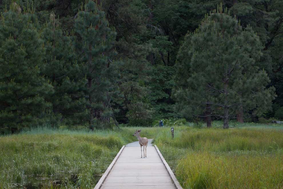
Jay is super afraid of wild animals, (as well he should be) and we talked a lot about bear survival skills on the ride there. So, it was hilarious seeing him geek out over this deer who strolled right past us!

We continued to explore the valley and I was snapping pics of Yosemite Falls, with a small pond and some nice reflections.
Two men approached. “That’s a great photography spot, are you guys staying for the moonbow later?”
Has anyone ever heard of a moonbow? Not me.
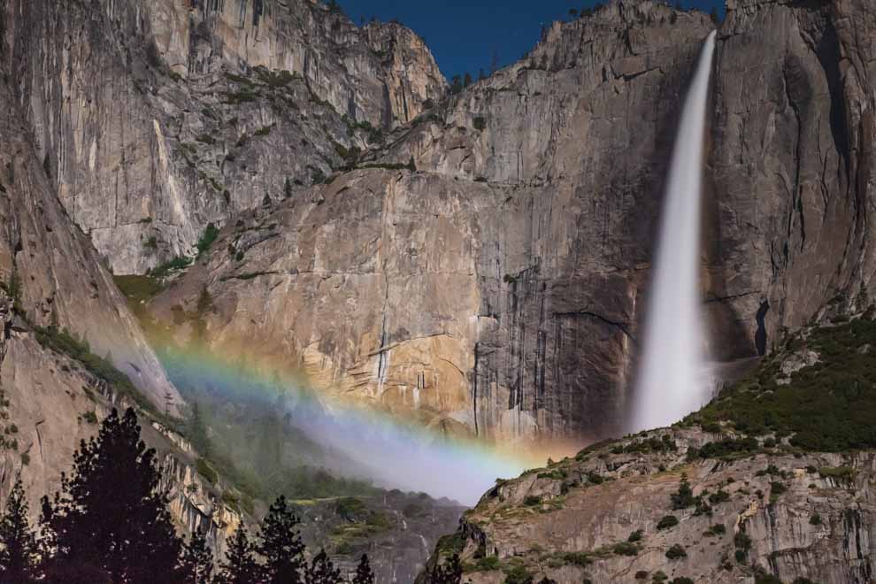
“A moonbow” he explained, “is a rare phenomenon when a ~full moon is in the exact angle and illuminates a rainbow in the mist of a waterfall. And, this just so happens to be one of the best and only nights of the year for it.”
Apparently, the moonbow was starting at 11:30 pm and all these photographers camp out hours beforehand to get a good spot to snap the bow.
We had 3 hours to kill, but Jay and I decided to dig in and go for it. What are the chances we came on this particular day!? Can you say 'serendipity?'
The weather was going to be in the 30s, and we had warm clothes, but we needed to replenish our snack bags. I dropped Jay off at the Yosemite Village Store to get supplies and we agreed to meet where we saw the deer crossing.
I set up my tripod right next to the pro photographers, who had multiple cameras and were well prepared for the night. Got my shot lined up!

After a while, I was thinking it would be smart to put my snacks back in the car, so as not to attract any new bear friends. I ran to my car and I realized....
Whoa...it is PITCH BLACK.
And, where is Jay!?
I started to get worried. The Village Store was only a 10 minute walk and Jay had been gone for 45 minutes to an hour. I get no cell service in Yosemite Valley, so we can't communicate. His phone battery was almost dead and he doesn't have a flashlight…
So, I hopped in my car quick and drove to the Village Store. No sign of Jay. And, now that it was so dark, the route from the Store to our meeting point was indeed confusing!
Panic started to set in. I tried to stay calm, as I packed up my camera gear and got ready to search. I told the photographers “If a tall Puerto Rican guy named Jay comes around looking for his friend, keep him here!”
For the next 2 hours, I drove back and forth from the Village Store, to the meeting point, around the Valley, searching, trying to stay calm...asking people "if they saw any tall Puerto Ricans", telling them to detain him if they do.
I wasn’t worried that he was going to die in the woods, although it was going to be ~30 degrees that night. I was a little worried that somehow the sick and twisted universe was going to introduce him to a family of bears!
My mind was playing tricks on me.
I went through a range of emotions. I was momentarily mad that I would be missing the moonbow! Then, I realized how selfish that line of thinking was, when my friend was lost out in the cold, dark wilderness with no light!
He had warm clothes and snacks. But, how we were going to find each other, with no cell service, and given that our hotel was over an hour away and it was pitch black!?!?!
I tried going to the Yosemite Lodge to get wifi, thinking, maybe he texted me (Unlike me, he got a weak signal in the Valley). But, the Lodge couldn’t give me wifi unless I was a hotel guest. BLURG!
I spoke to Park Rangers, Bus Workers, etc. Most of them seemed fairly annoyed, condescendingly telling me to just go back to the meeting spot and wait. Yeaaaaaaa, I don't think you know my friend Jay and his familiarity with the outdoors. Homeboy needs a search party, pronto!
At this point, it had been almost 3 hours. My last resort, was driving back to Mariposa, and seeing if he was at the hotel. Maybe he hitchhiked there? But, that seemed like such a risky prop, as it was an hour away. I didn’t want to abandon him in the Valley if he was wandering.
I drove around the Valley one last time. Almoooost turned onto the road back to the hotel. But, I stopped at our meeting point, and it was just about 11:30. I asked the photographers: “Has the moonbow started yet? Have you seen Puerto Rican Jay?"
Out of the dark, I hear a voice: “Matt? Matt Sherwood?”
I look over, and Jay is sitting down right there, all bundled up.
We looked at each other and I cannot describe the feeling. I wanted to punch him!!! Out of brotherly love and frustration, of course. But, we just mumbled obscenities to each other and gave each other a big ole bear hug. #punintended
We hopped in my car and Jay said, "Hey I got those snacks!" as he pulled out a steak sandwich, and a bunch of other eats, which I couldn’t even stomach because the fear and adrenaline were coursing through my veins and overpowering any normal bodily functions.
After trading several, “You have no idea what I've been through's", we decided to pull out the tripod and go try and catch some moonbow action. It was exactly the right time for the moonbow to start!
After all that madness, we did NOT miss the moonbow! Got some cool snaps and headed back to our hotel, where we couldn’t sleep until the adrenaline sent us crashing back down to Earth.
Want to see what a moonbow looks like?

Welcome to Yosemite National Park! Day 1, done. At least on Day 2, there’s no way we could top this madness, right?
Right...?
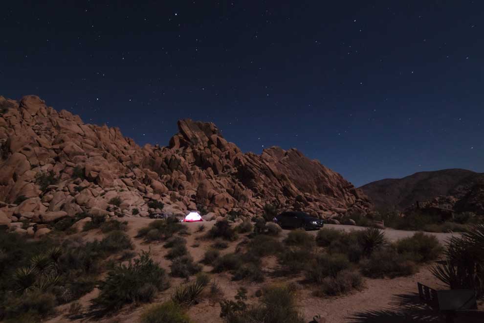
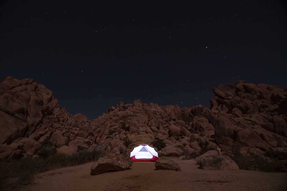
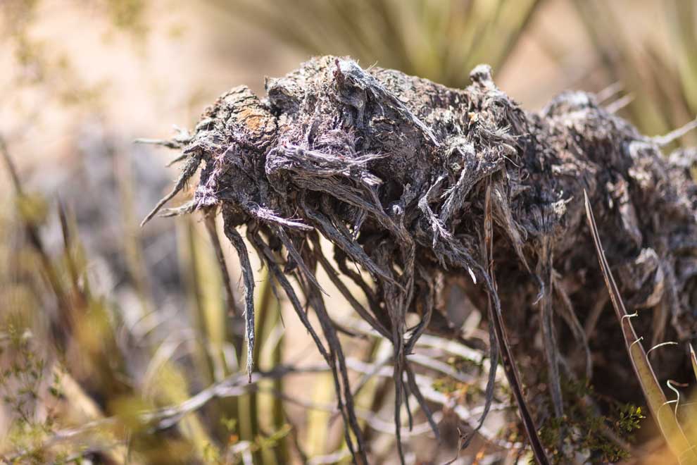
Joshua Tree National Park (in June)
I’m almost embarrassed to admit I had never been to Joshua Tree, ~2 hours from LA. This rare jewel hidden deep in the desert is fascinating and freaky and hotter than hell (in June).
I’m almost embarrassed to admit I had never been to Joshua Tree National Park which is only ~2 hours from LA. This rare jewel hidden deep in the desert is fascinating and freaky and hotter than hell (in June).

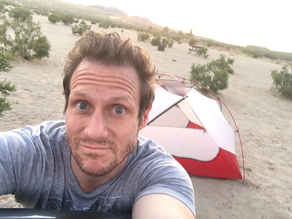
Campground #1, Joshua Tree Lake Campground
When I first got into Joshua Tree, I realized that I'd have a lot of freedom to sightsee, camp and hike because June is the off season. It’s dangerously hot in June! But that didn’t stop me.
I think I was one of 3 people in the Indian Cove Campground which has 101 campsites.

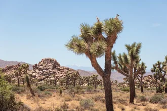
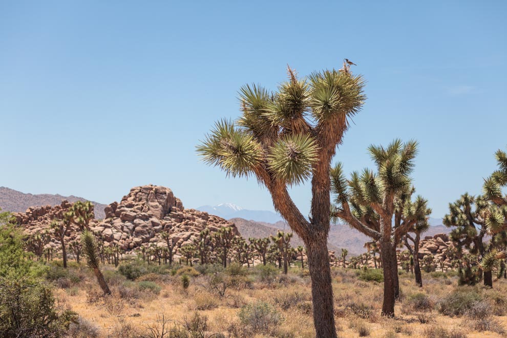
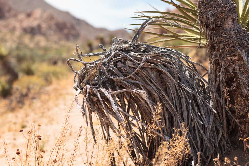
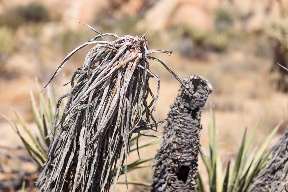
Joshua Tree National Park is essentially a big garden of Joshua Trees in the Mojave Desert. Which, at first, I thought was a bit strange. Why isn't there an Oak Tree National Park?
But, there is something mystical about these Seussian looking trees and the fact that they only grow in this specific unique climate. Very surreal.

The trees have this Keith Haring-like energy to them, almost as if each one is caught mid-dance:


And, I'd be remised if I did not mention that Joshua Tree is a rock climber's paradise! (Just not in June)
After a day or two of sweating, hiking, sweating, camping, sweating, hiking --- my hair started to reach for the sky and resemble the trees!

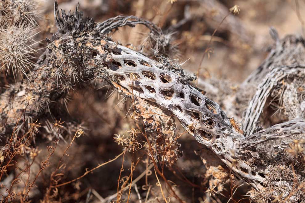
Maybe it was the heat stroke, but I started to see creatures in the desert flora. Seemed like the cacti turn into monsters when they don't get enough water.


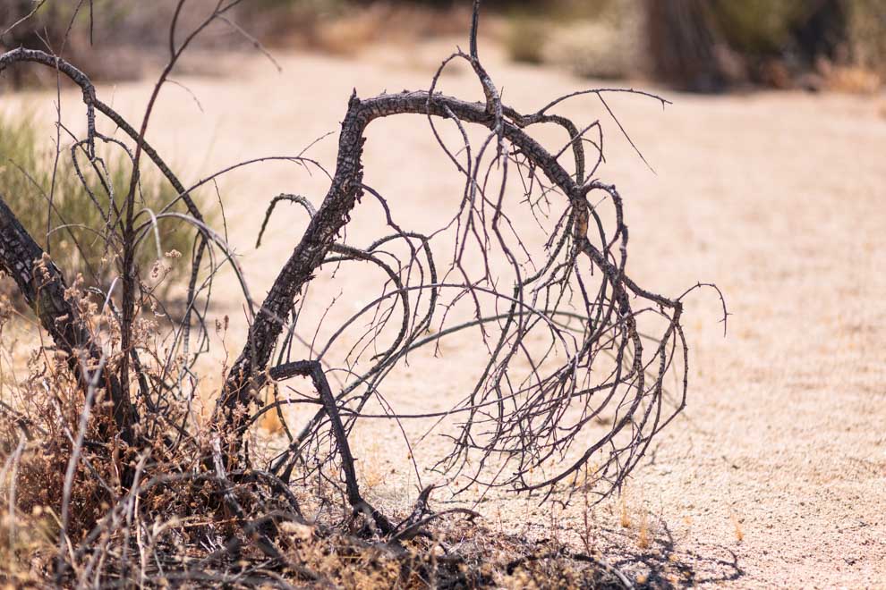
Decaying cacti look weirdly otherworldly:
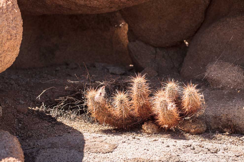
Some desert animal made a nice little camp in this small cave, using some especially caustic cacti to shield their nest from nasty predators:
Ran into a tiny toddler tumbleweed, that acted all timid when the camera started rolling.
Joshua Tree has these cute little creamy colored chameleons that blend in with the light sand.

How has this big boulder not toppled?
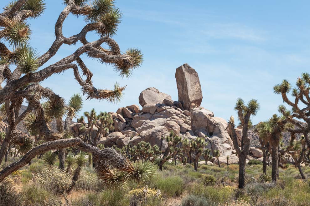
Skull Rock!

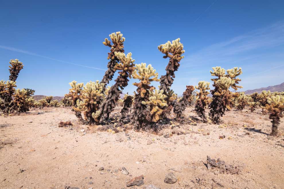
If you visit Joshua Tree, I highly recommend stopping by the Cholla Cactus Garden! More Seussian shrubbery!

One hiker I ran into said, "Yeah, it looks like someone just dropped a pile of rocks in random spots around the park. So true.


Overall, I had a blast exploring this national park, even in the hellish conditions.
Joshua Tree is a mystical must-see attraction!
Just don't go in June!
Borneo's Wicked Wildlife - Pt 3
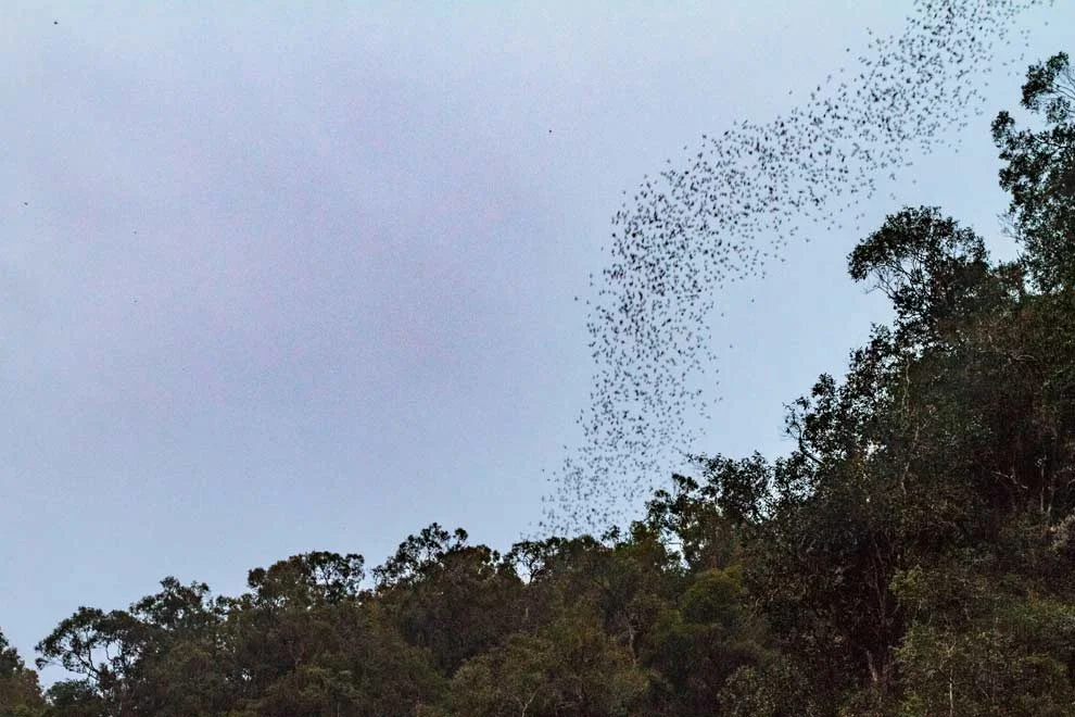
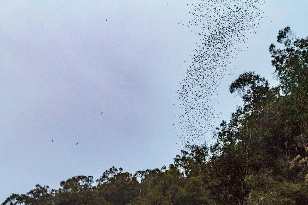
Want to know what millions of bats flying out of a cave looks like? Check out part 3, the finale of Borneo's Wicked Wildlife, featuring the bats in Gunung Mulu National Park!

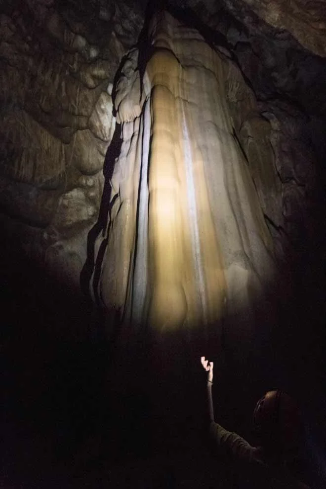
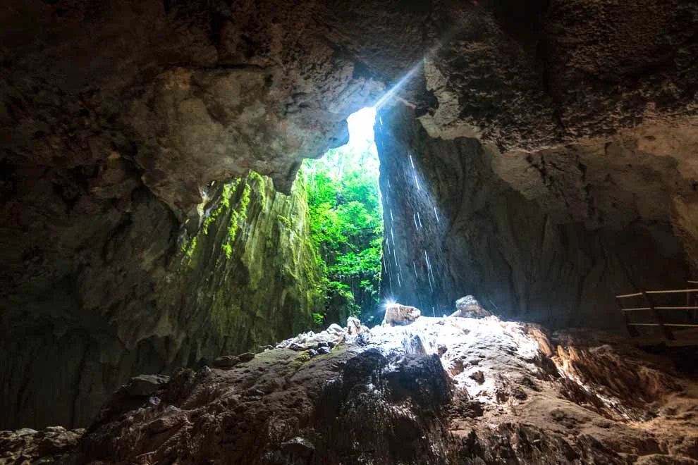
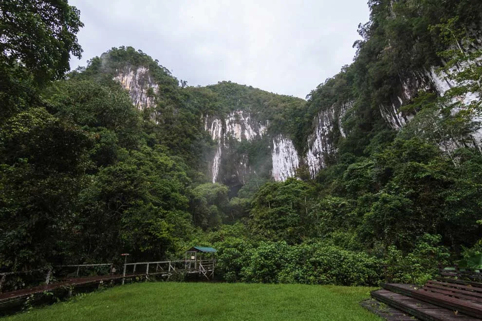
Years ago, I watched BBC’s Planet Earth series and was transfixed by the Caves episode. Bats, snakes and insects make up this incredible ecosystem. Borneo’s Mulu National Park boasts some of the world’s most impressive caves and underground passages and is featured in the BBC episode I saw. Mysterious Mulu was beckoning me…
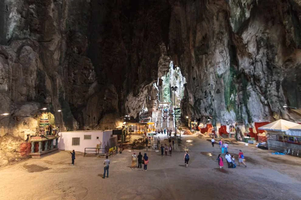
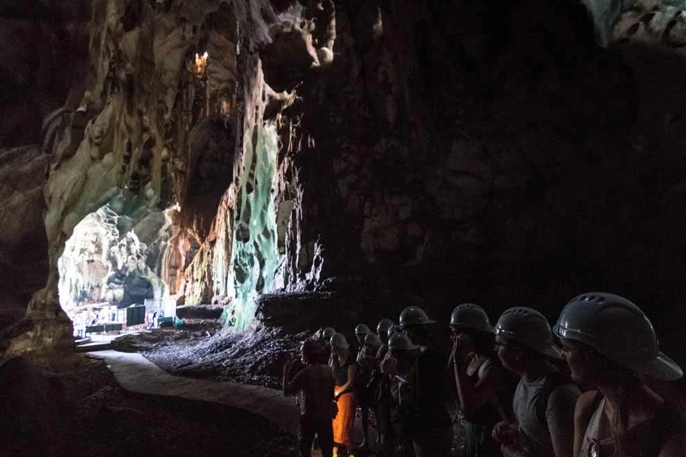
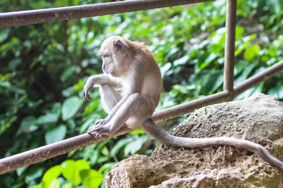
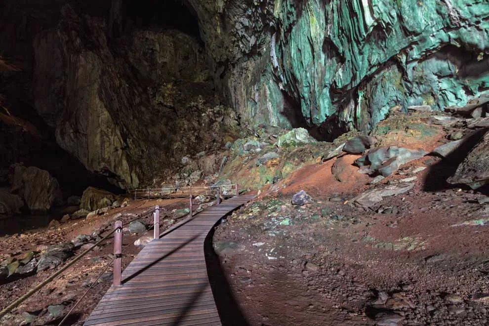
In Kuala Lumpur, we visited the Batu Caves, which was basically Mulu’s baby brother. It was but a mere appetizer before the Mulu main course.
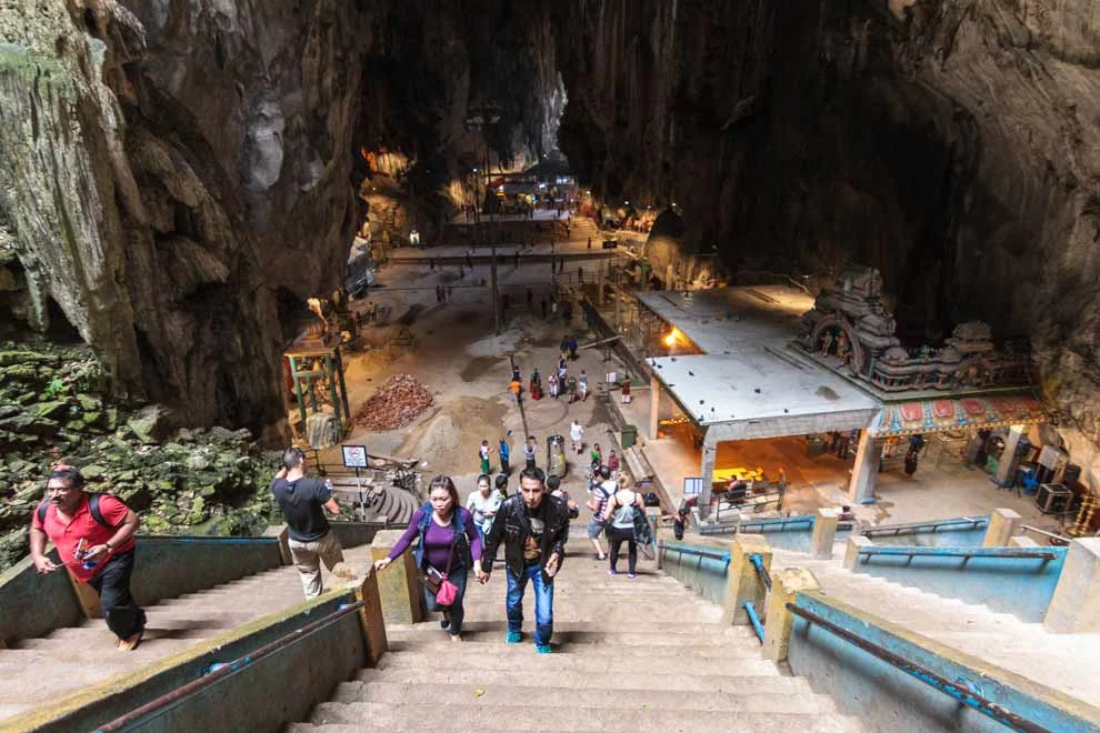
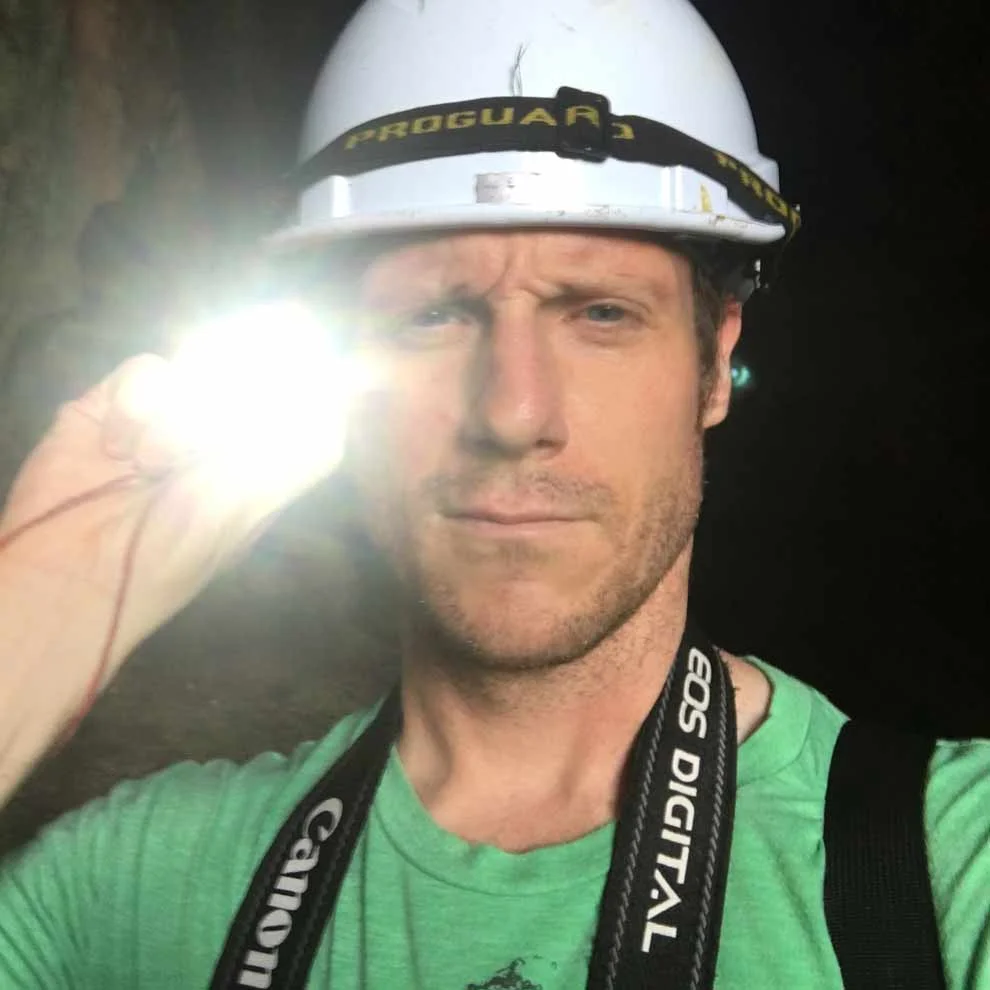
We took a headlamp guided tour of the dark caves.
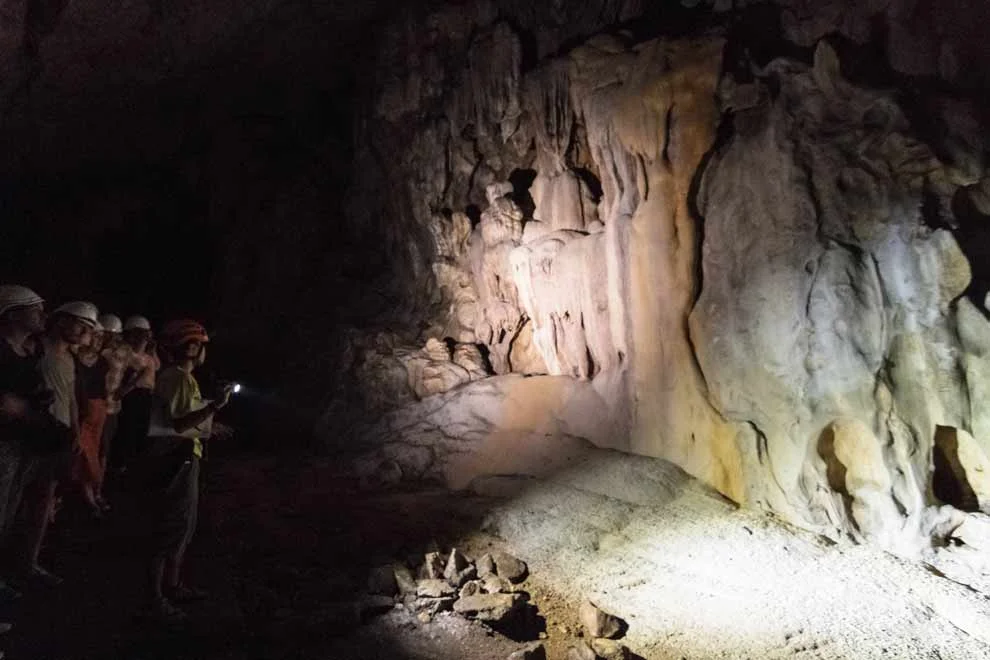
You see centipedes, and spiders and scorpions, and worms, and cockroaches, and all sorts of creepy crawlers.
And the whole time, you hear the chirping of bats above you.
But, the thing is, it’s not scary. It sounds scary, but, it’s actually quite peaceful.
Algae grows on the rocks that get sunlight inside the caves
The highlight of the tour (for me): deep in the dark trenches, they ask everyone to turn their headlamps off. We sat in the dark for a couple minutes, just listening to the chirping, the scurrying, the slithering, the whoosh of the wind and drips of water.
Nothing living in the caves has any interest in getting near humans. You have to trust that.
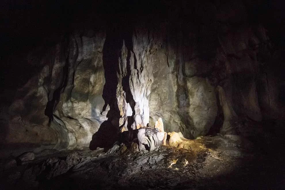
Deep in the dark caves, there really is NO light. You try to adjust your eyes, and still it’s complete pitch black. In normal nighttime environments, there exists some moonlight, and or ambient light. Not in the caves. Pitch black. It was INTENSE.
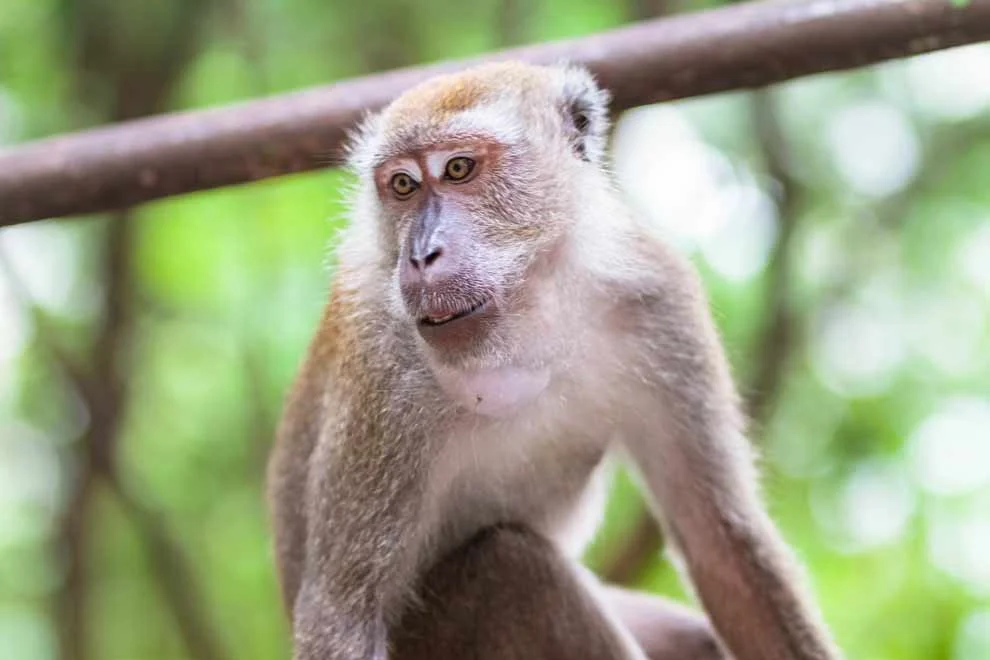
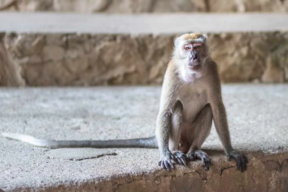
Once you get out of the cave you are confronted by tons of devious monkeys that seem like they are plotting or concocting some 12 Monkeys type plan...
But, that was just the Batu Caves! Back to Borneo...
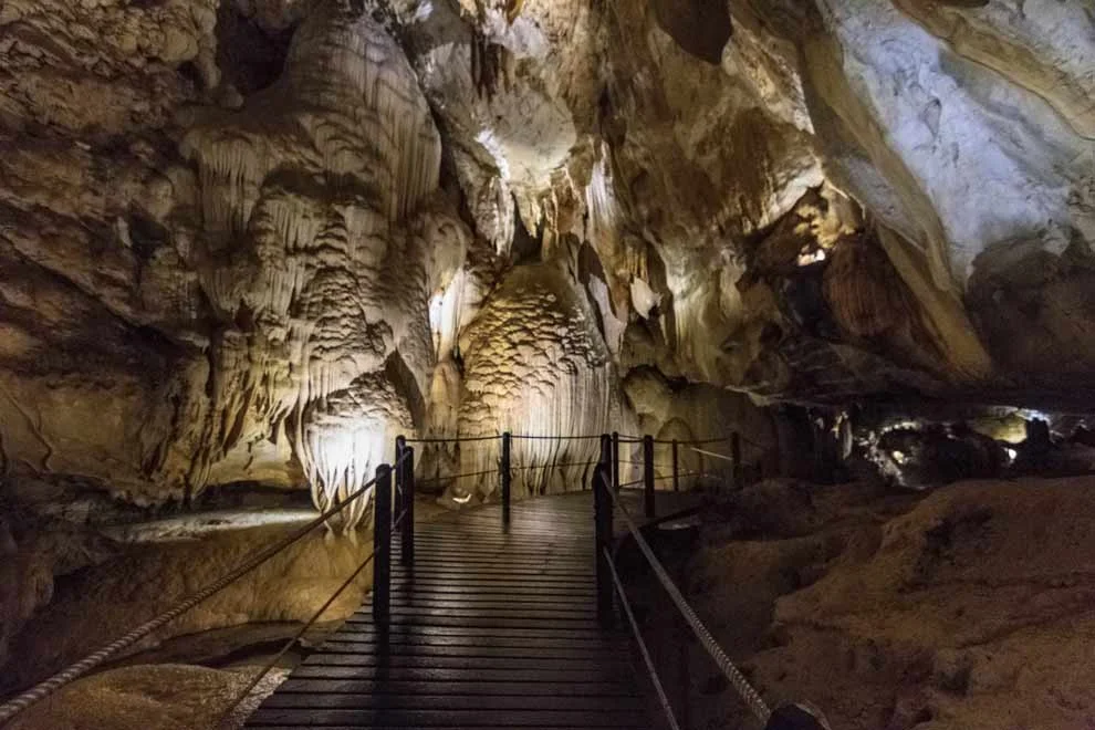
Gunung Mulu National Park is a UNESCO World Heritage Site, protected because of its unique wildlife and plant life and protected so people of future generations can visit and experience the beauty.
Mulu was next level cave madness. WICKED. WEIRD. And, MAGNIFICENT.
First, my hotel, the Mulu Marriott. It's nestled right into the rainforest. Just listen to the awesome SOUND of the jungle. I love that sound. Constant buzz, chirping, yawping geckos and frogs. So weird.
The Mulu Marriot’s mascot is the gecko (kinda). They sell gecko stuffed animals in their hotel store. Each guest gets a gecko in their room (joke). Here's mine:
Now, unfortunately, there was monsoon-season rain every day, and I did not get to go on the canopy walk, or the night hike, where I would have seen tons of crazy lizards, centipedes, etc. But the real attraction was the bats in the caves.
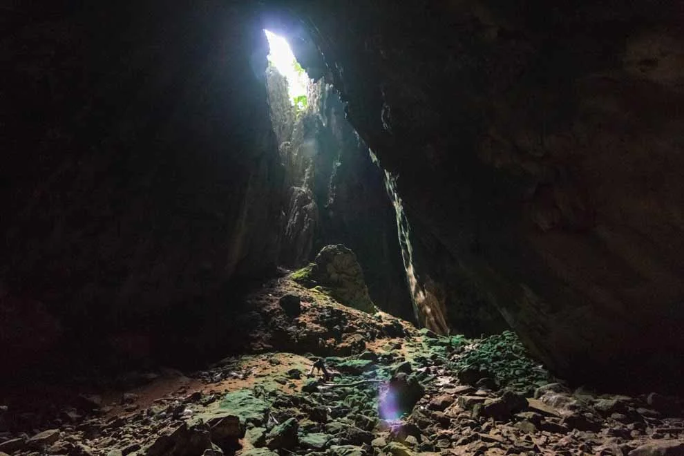
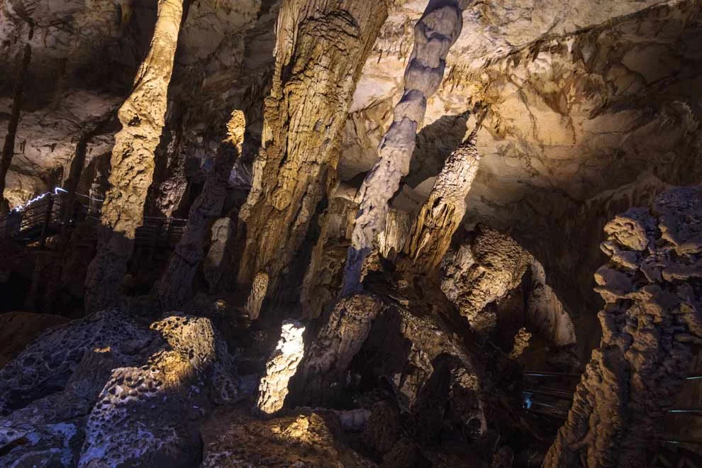
There are 4 main “Show Caves” that most tourists visit.
Deer Cave (named because Deer used to run through the passage and lick the salt covered rocks)
Lang Cave (Gorgeous interior walls that look like jellyfish)
Clearwater Cave (because of the gorgeous river running through it)
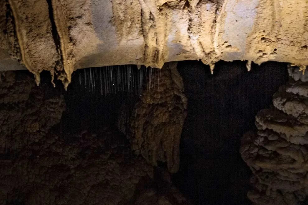
Cave of the Winds (named because of the wind vortex that exists in some of the narrow passages. Tons of cool stalagmites and stalactites!)
The caves are home to MILLIONS of bats. Bats are a vital part of these ecosystems---pretty much everything revolves around them. They eat mosquitoes and other insects. They poop out “guano” and other insects eat the guano, and other insects eat those insects and the circle of life continues.
I am thankful for the bats, because there’s enough mosquitoes in the rainforest already! I’ve got the bites to prove it.
In addition to the bats, there are Cave Swiftlets: birds that use a type of 'clicking' sonar. The chirping of millions of bats and then the clicking of the low flying swiftlets. INCREDIBLE.
The clicking gets more frequent the closer they get to their target. Click, click, click, click, click, click...like a horror movie.
Spooky-key-kuh key, key-ku-key, key-kuh-key.
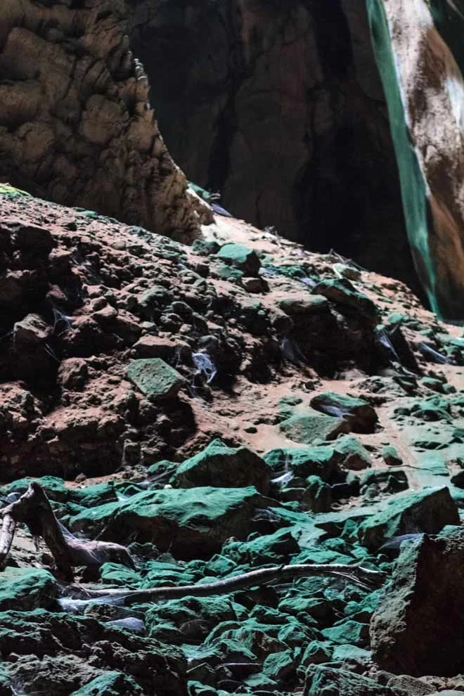
There are also millions of spiders in the caves. They post up on the walls, and catch flies and other insects. Check out how many webs there are:
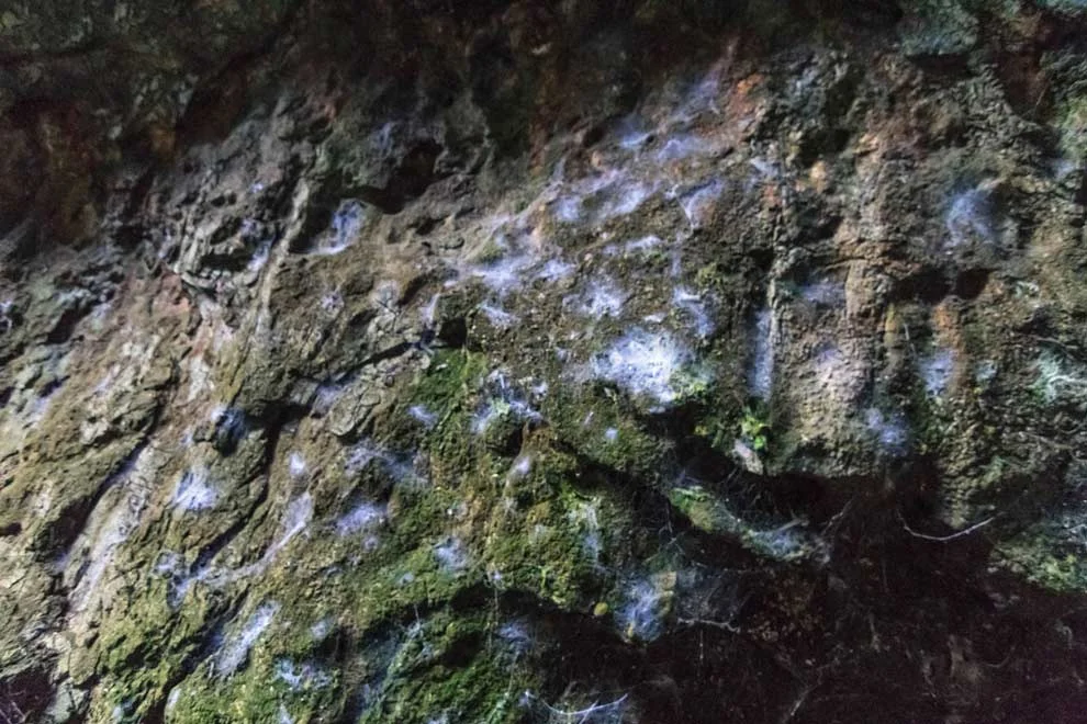
This is a different type of web, spun by the thread worm. It hangs and traps flying insects:
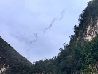
Day one of the tour ends at the Bat Observatory, outside the Deer / Lang Caves with the possibility of seeing the bats fly out of the caves in formation to feed.
Some lucky visitors get to see em. Some don’t. Some folks I met tried two nights in a row, and the monsoons were too strong --- no bats.
But, wouldn’t you know it, I’m like the Lucky Charms leprechaun and even though it was raining, they came out to play.
They come out in waves. About 5-7 mini groups exit the cave first. They flock in beautiful ribbon-esque formations. After the mini groups, the rest of 'em fly out in one long ribbony stream that can last ~45 mins! (Ours lasted about 5 minutes. Most likely not all came out due to the drizzle of rain) It's almost like a fireworks show with the grand finale.
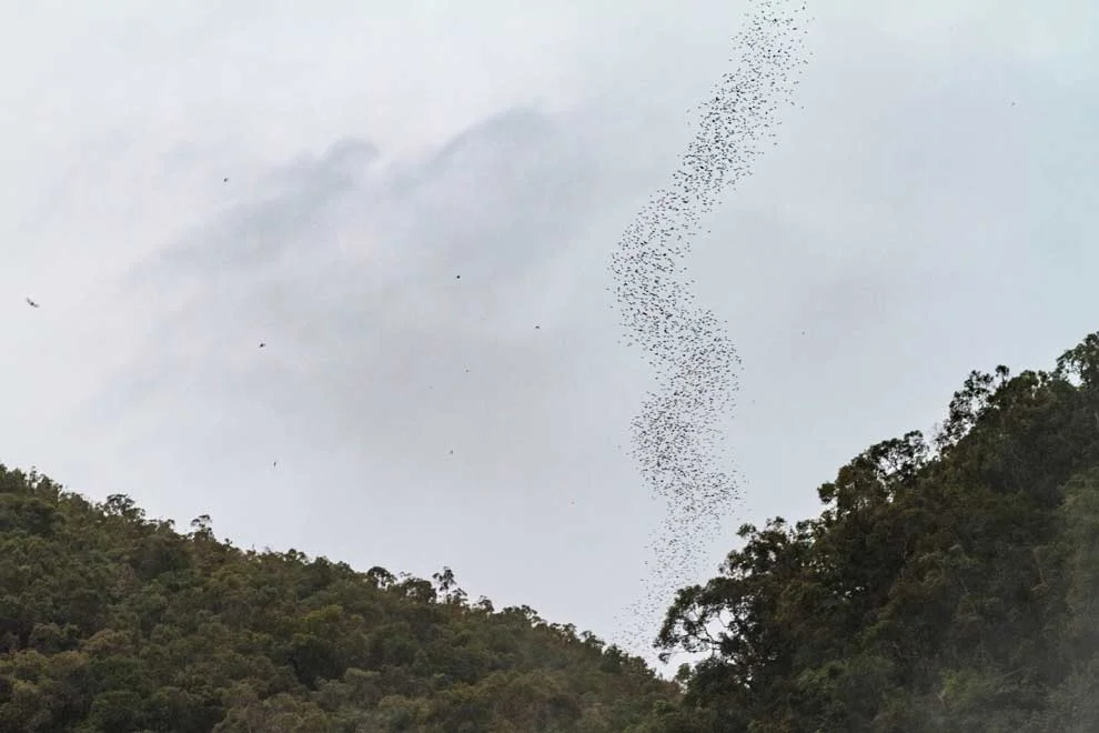
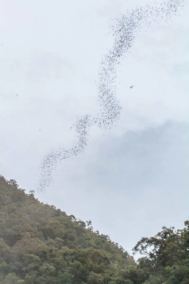
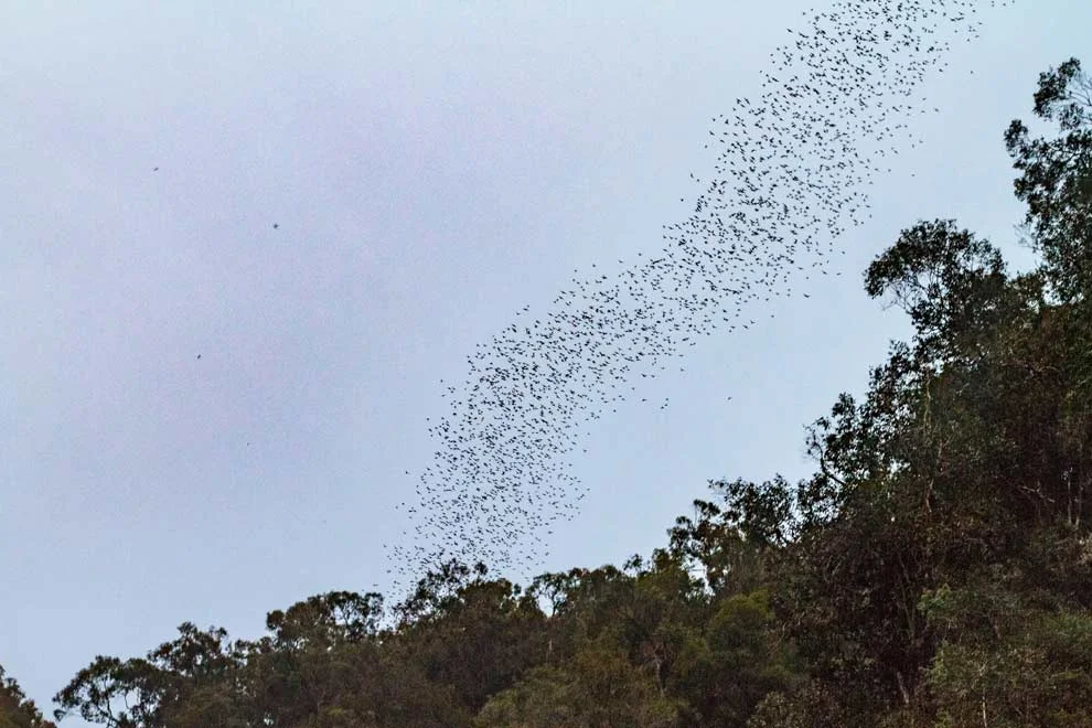
Not a lot is known about bats and why they fly like this. Bats are blind, but SHARP. Their sonar is on point.
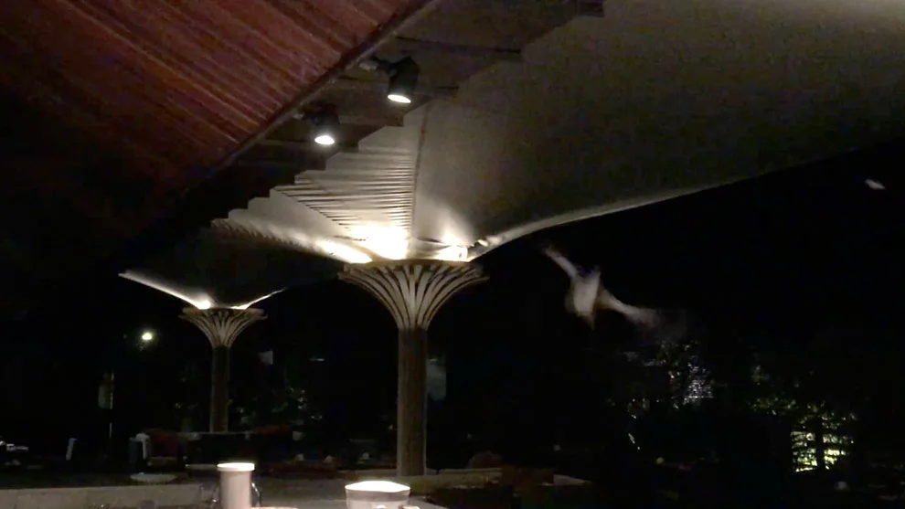
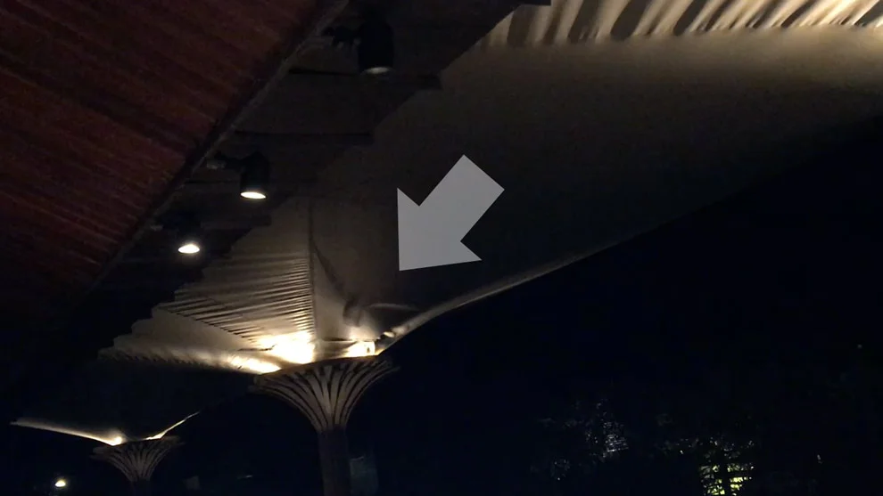
At my hotel the following night, I was having dessert at the pool bar, with a Dutch couple, and we realized bats were flying underneath the ceiling of the outdoor lounge and literally right over our heads. They’ll fly so close to you and so fast, but never hit you.
My, oh, my, Mulu is magnificent!
The idea of visiting caves that are fully encrusted in bat guano may sound gross to some, but for me it was spectacular.
Seeing the bats fly out of the cave was bananas. It was the icing on the cave cake.
That’s it for the Borneo’s Wicked Wildlife blog series. Borneo was one of the best travel experiences of my life because it was just so different and exotic. Never had been to the rainforest before ('cept one day in Iguazu Falls). But, Borneo was one week of wild and weird.
There is a buzz in the rainforest, literally. The sound of it is entrancing. And, I can hear still it in my sleep.
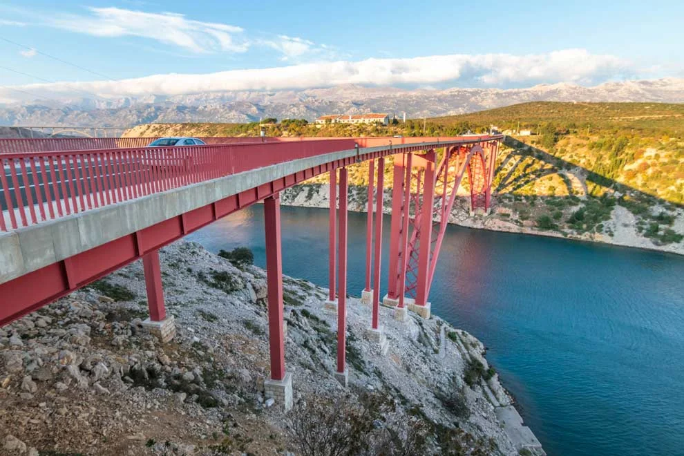
Chasing Croatian Waterfalls - Pt 1
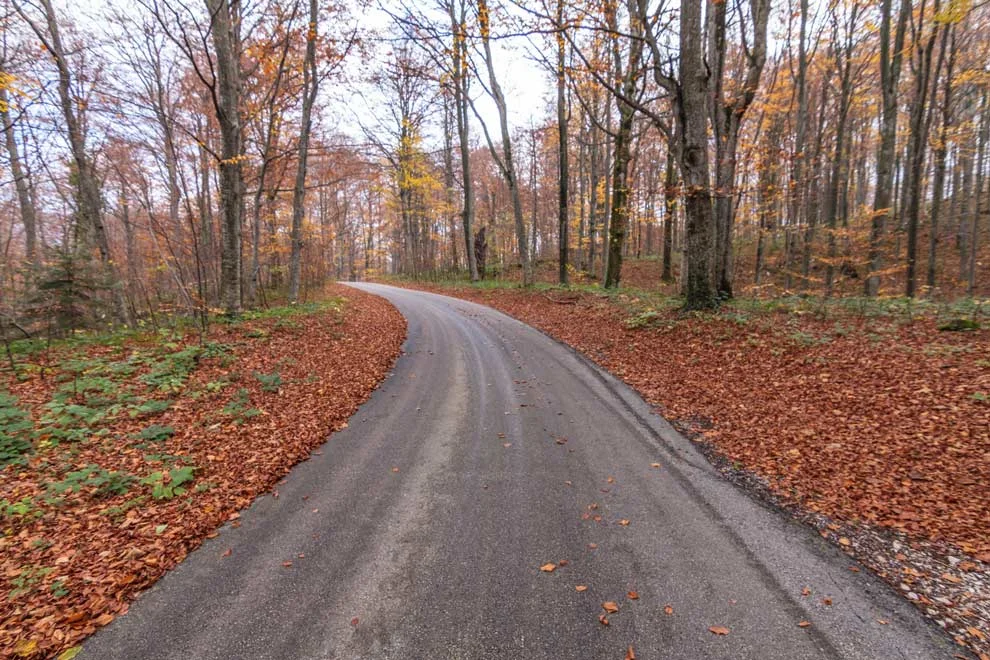
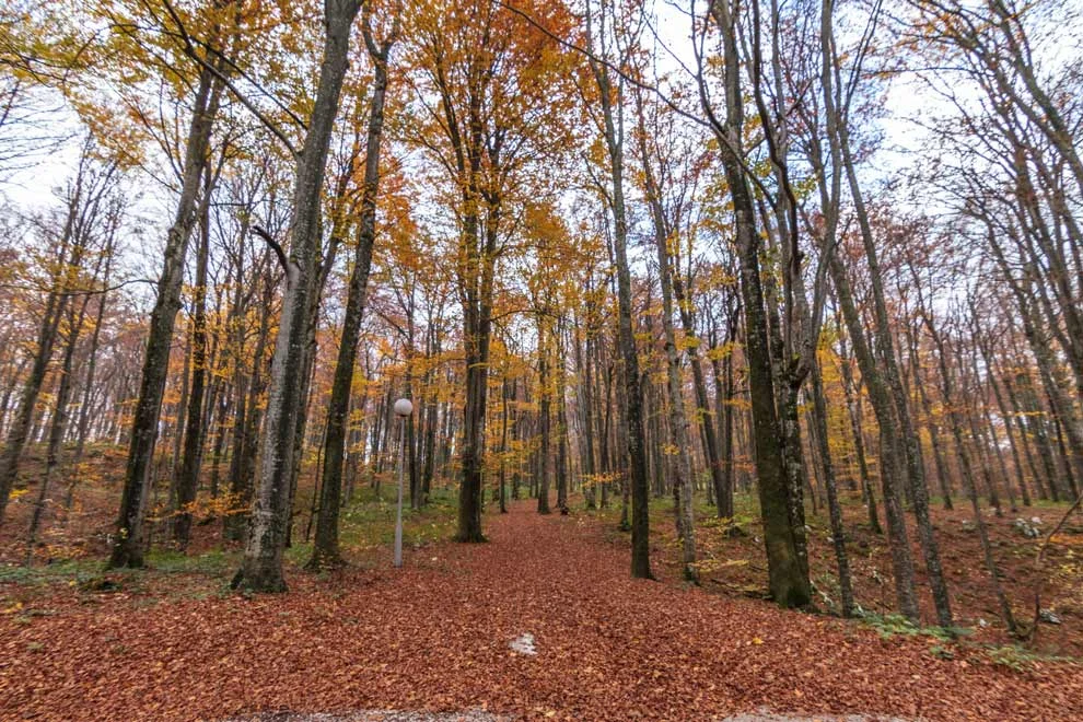
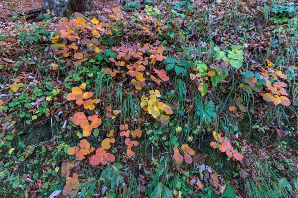
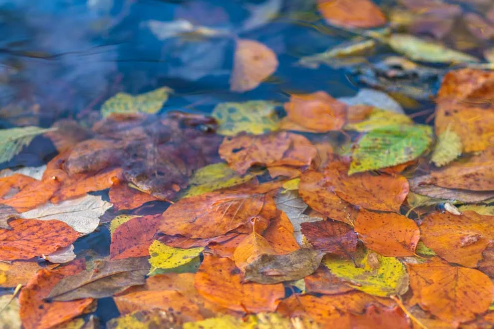
Croatia is home to some wicked waterfalls in: Plitviče Lakes National Park, and Krka National Park. I set out on a solo adventure and it was very nostalgic. It’s fall in Croatia and the leaves were changing color. The foliage reminded me of the US...a little...

Croatia is home to some wicked waterfalls in: Plitviče Lakes National Park, and Krka National Park. I set out on a solo adventure and it felt very nostalgic! It’s fall in Croatia and the leaves were changing color. The foliage reminded me of fall in the US (a little bit).
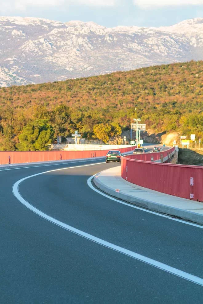
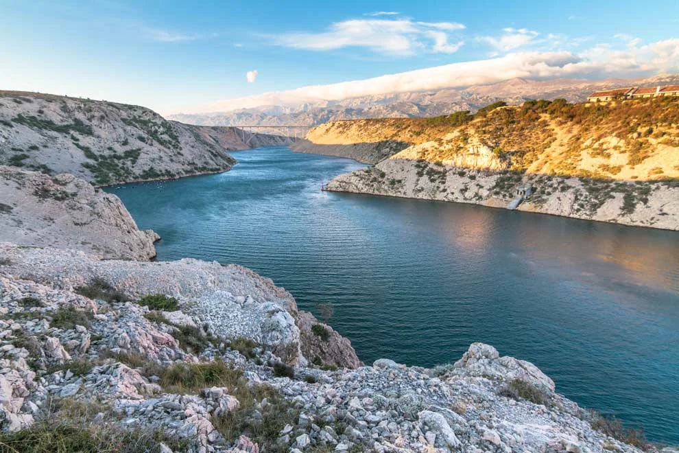
The drive up to Plitvice is ~2.5 hours. I was cruising up the freeway doing 140 (km/hr), and the weather was perfect! I was thinking how easy the trip was going and how happy I was to be on the road again.
Until, the freeway suddenly...just...CLOSED.
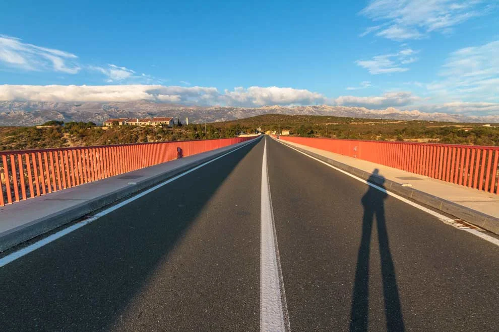
Apparently, there were severely high winds and it's not safe to drive on E65 in these conditions. The problem was, my SIM Card was broken and I had no way of looking up directions. I DID have an old-school GPS, but it kept re-routing me onto the freeway.
I drove up to the tollbooth and asked for directions. She rattled off a series of directions in her limited Croatian-English and I barely caught anything except: “You must take the OLD road”.
But how is one to know where the old road is…?
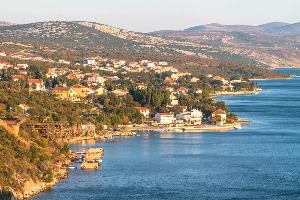
Drove around, back and forth in the middle of the Croatian countryside. And I realized:
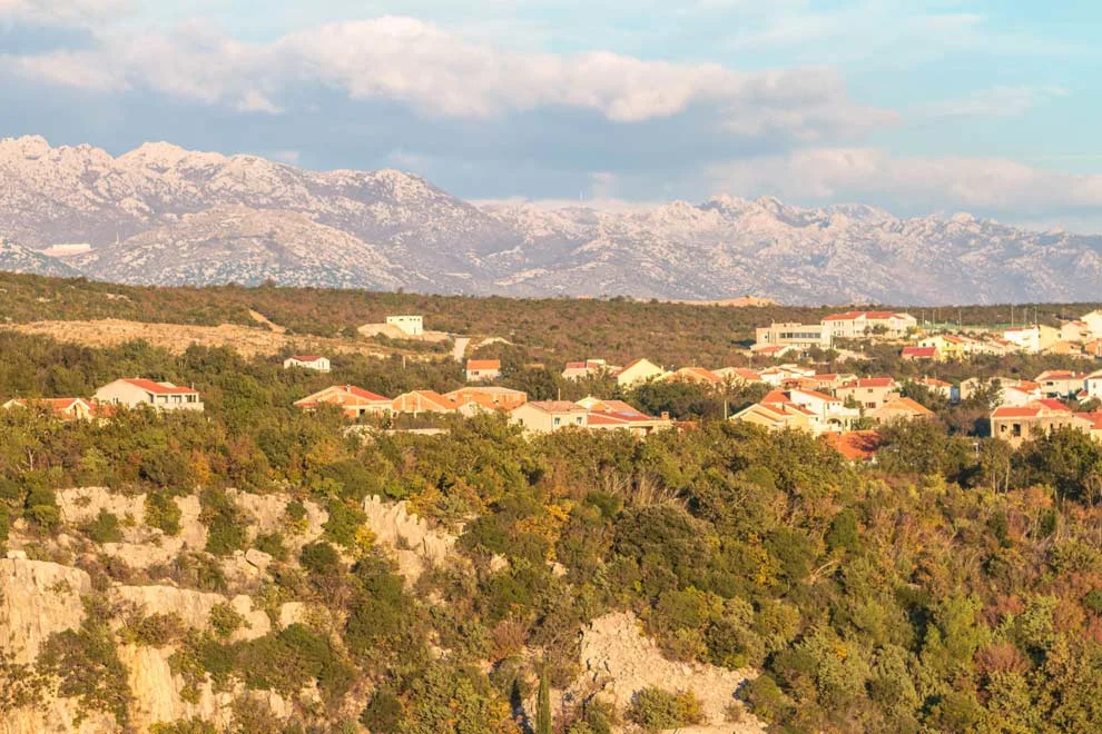
1. There are far worse places to get lost than Croatia! I was near some gorgeous lakes, with red and orange trees and big mountains in the background. Croatia is beautiful! I decided to stop and take some pics.
2. It is well past my pizza time. Croatia is near Italy and they are proud of their pizza. I must stop and fill the tank.
Stopping for pizza was helpful, as they tried pointing me in the right direction. But, I still got lost again. Finally stopped at a tollbooth for a second time and asked them to type directions into my phone.
I finally found the old road. Arrived at my AirBnB around 8pm. The trip was supposed to take ~2.5 hours. Instead it took ~7 hours. Oh well, I made it!
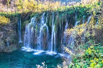
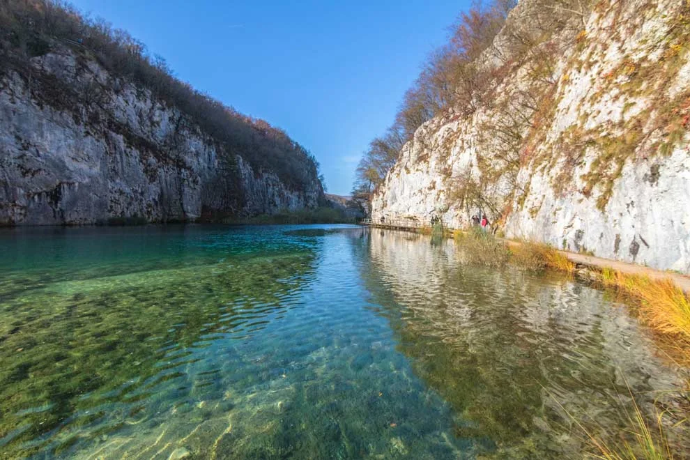
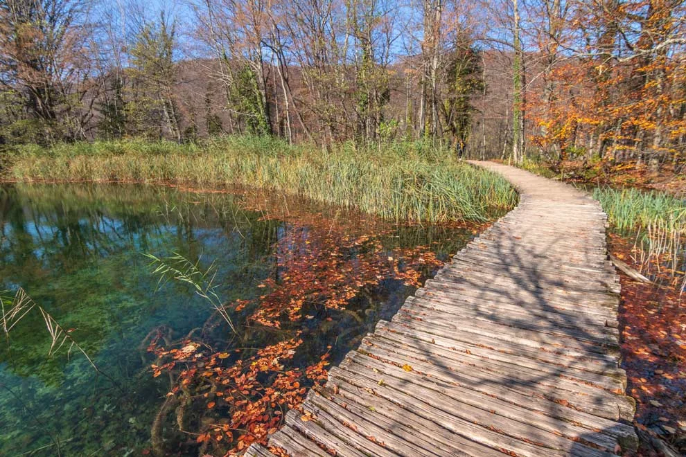
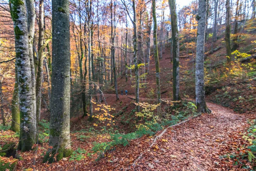
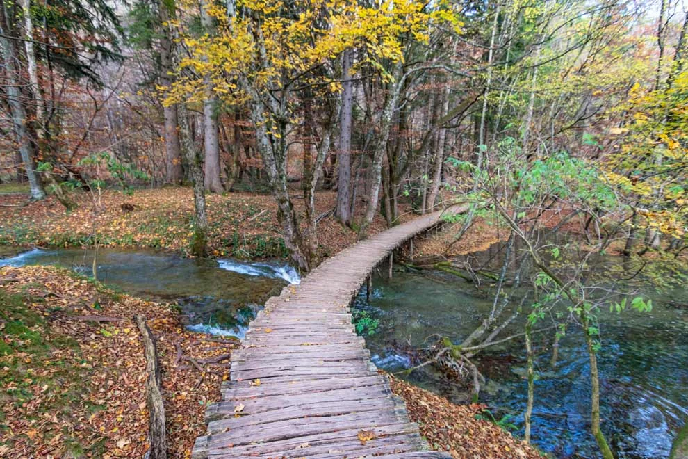
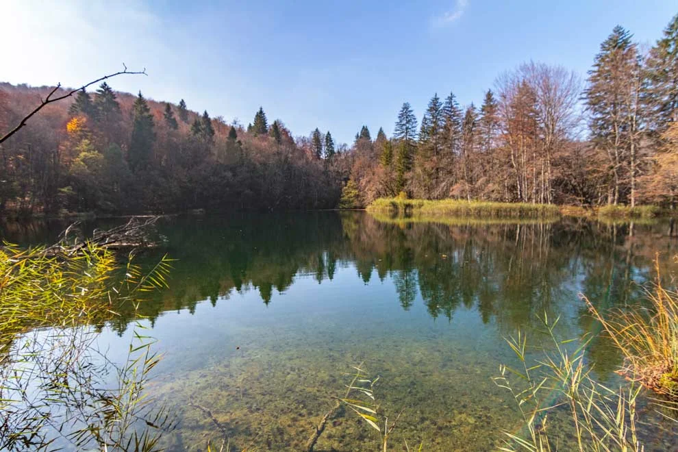
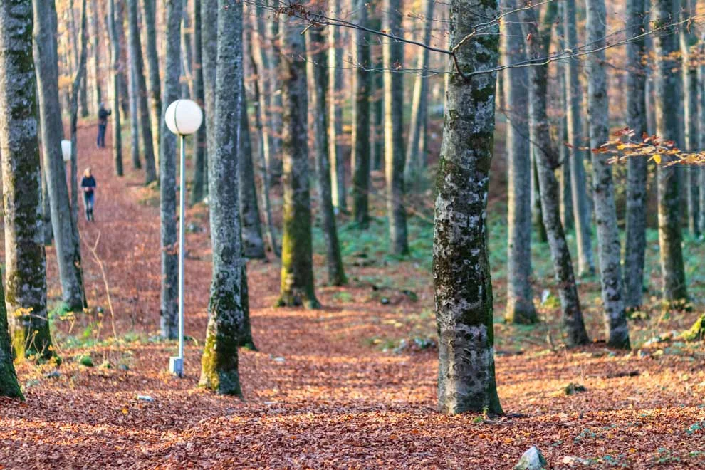
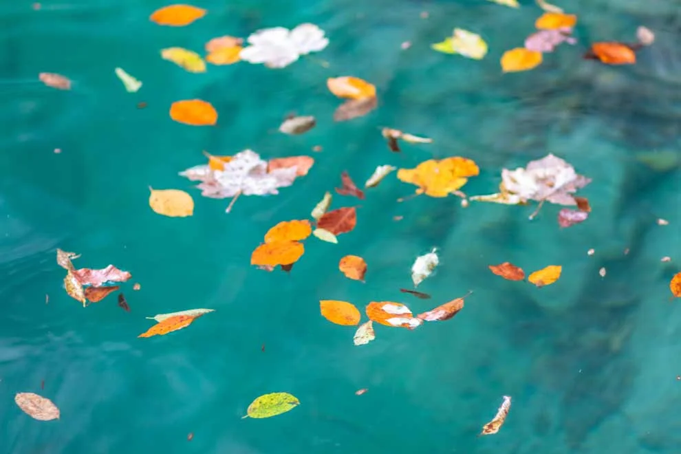
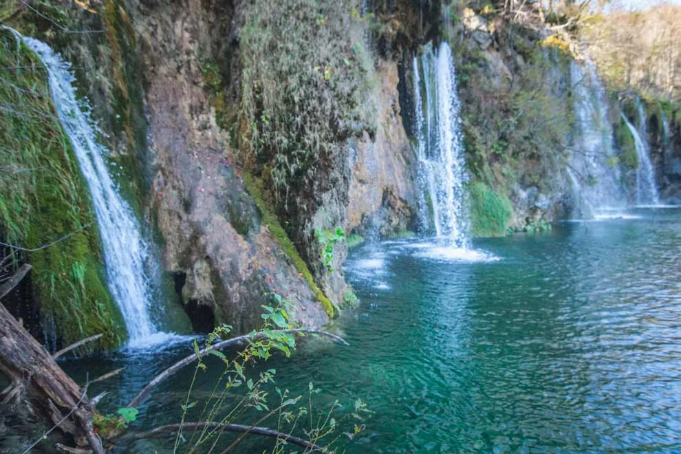
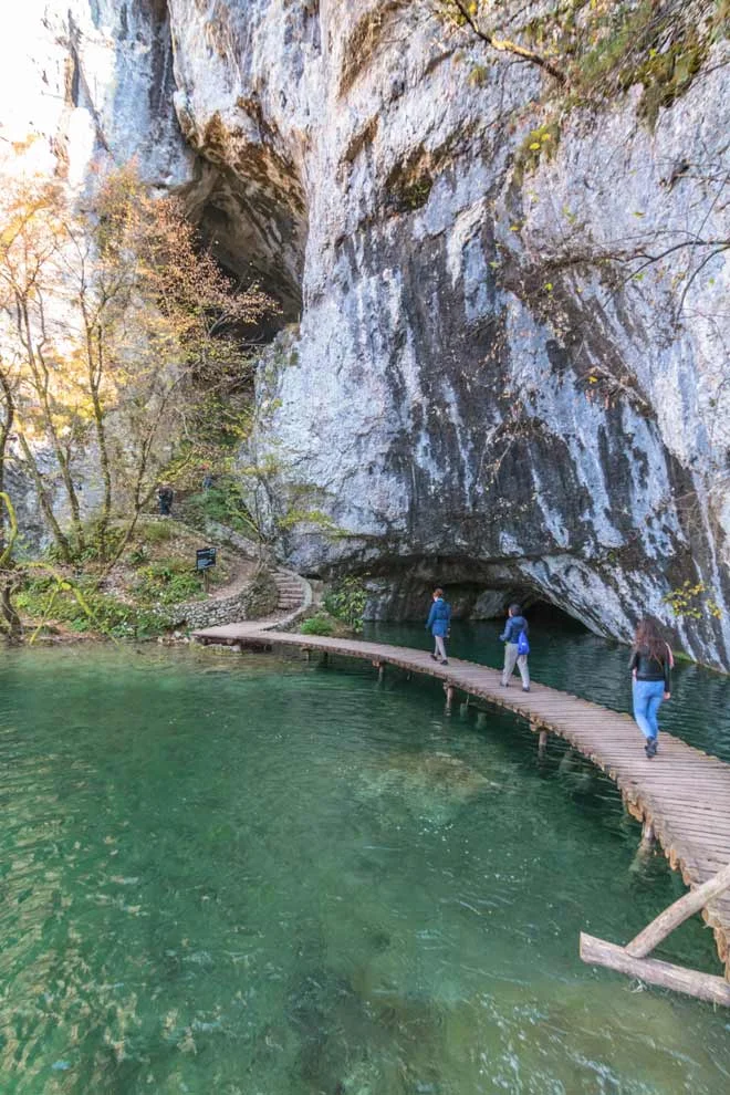
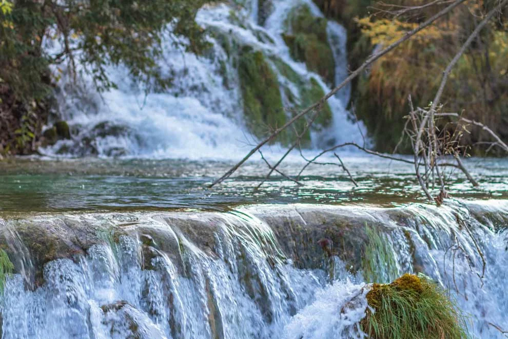
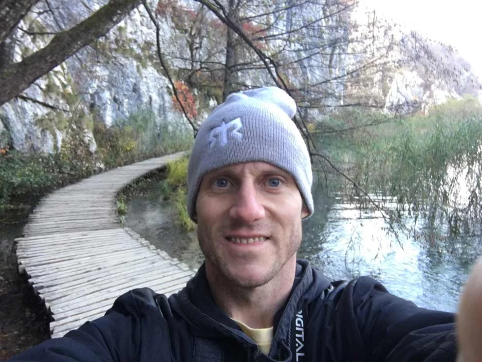
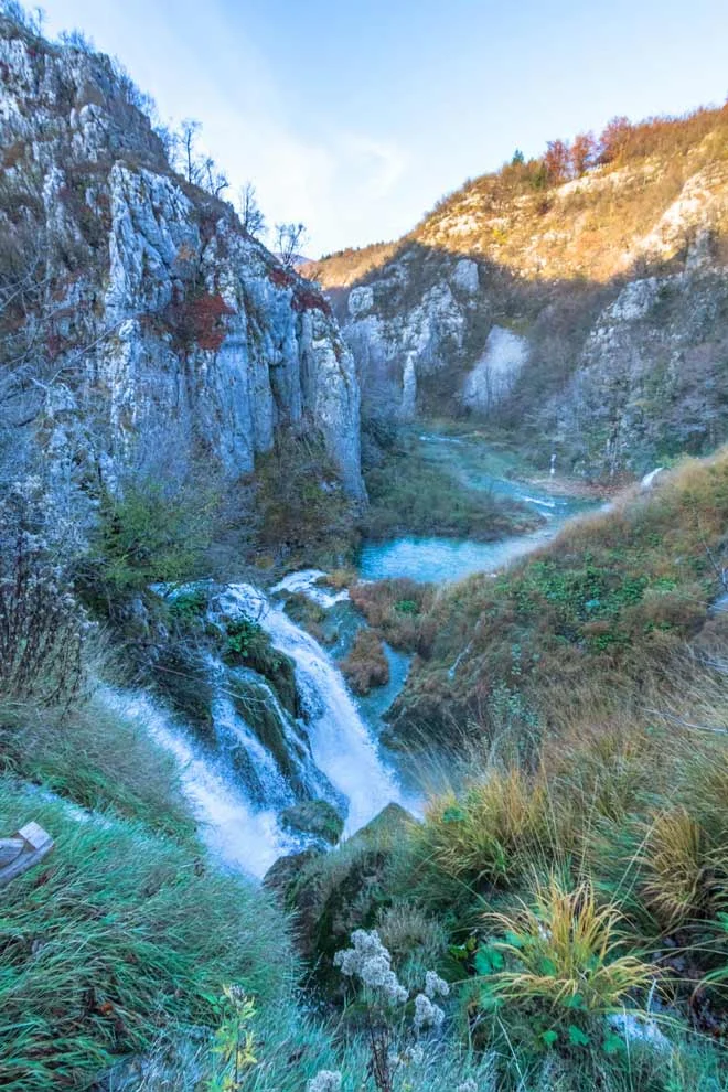
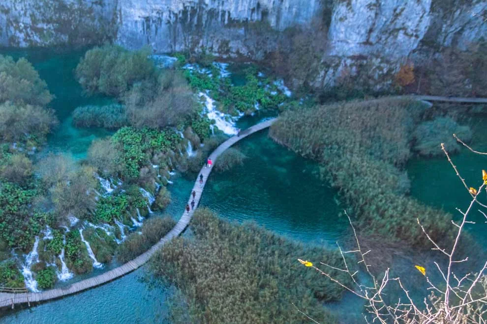
Plitvice Lakes National Park is pretty big. It is a series of 16 lakes that are connected by a wooden hiking trail and a series of waterfalls. It’s not the type of thing where you hike for a while to get to the ONE waterfall. There are several different hiking trails with MANY small waterfalls and lakes. I chose the H route, which takes ~4-6 hours to get through. This is the start of the H route---as you can see the lakes are crystal clear!
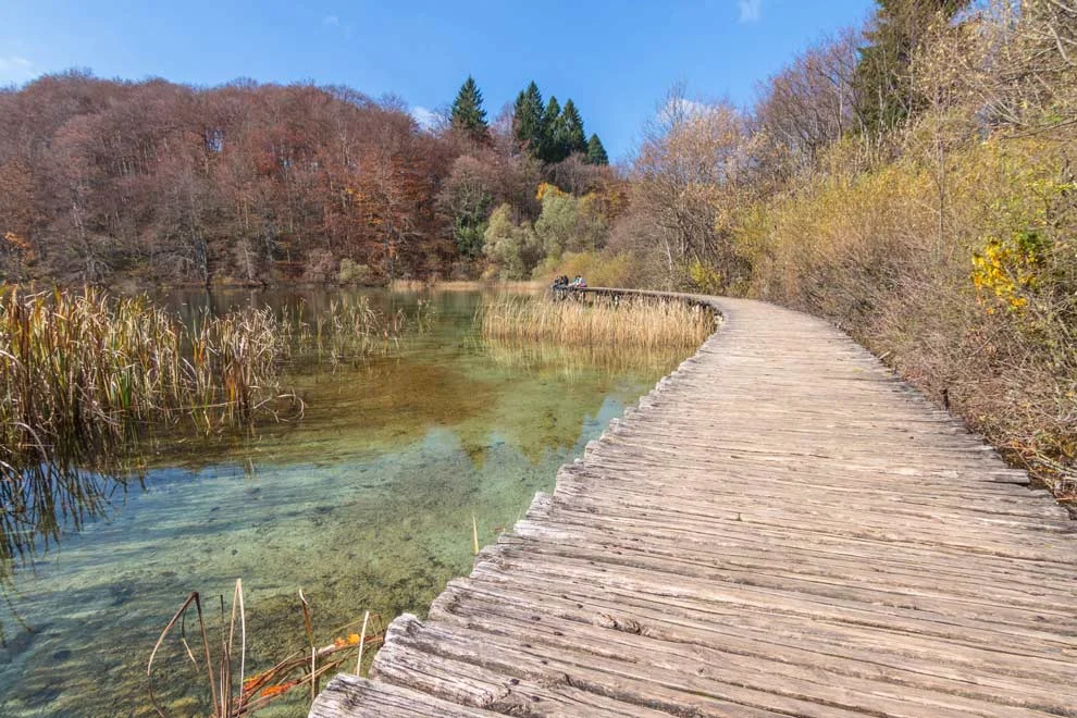
BTW, Plitvice is a UNESCO World Heritage Site. You can see why it is protected---it's wondrous.
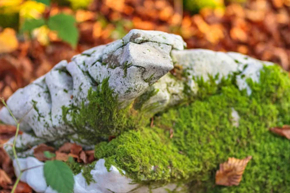
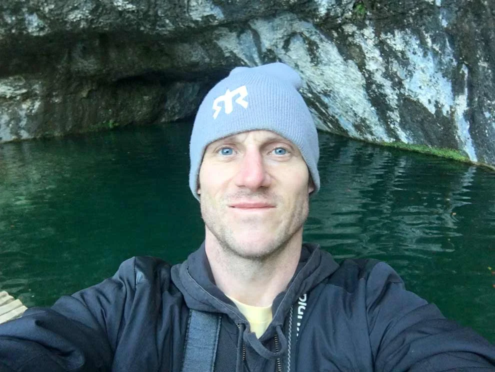
And, it was a beautiful fall day for a hike.
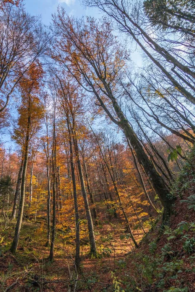
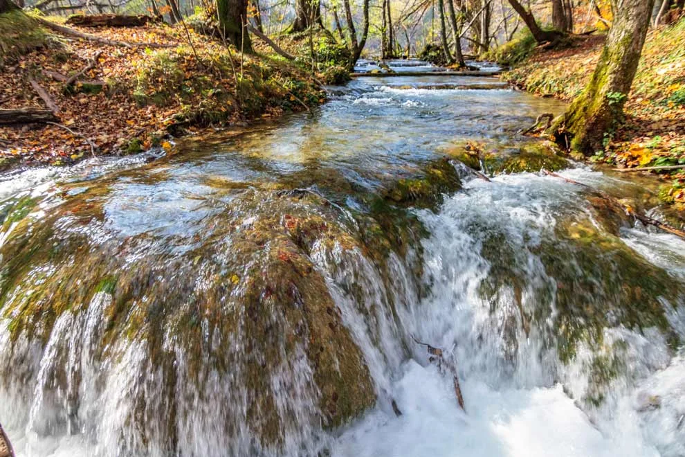
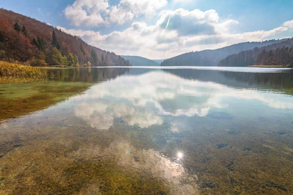
Unfortunately, I think going in the afternoon was a mistake. It seemed like every awesome waterfall had the sun right behind it, which killed my photography game.
Maybe it would have been better to go in the am? But I had worked until 5am the night before and then woke up around 10ish. (This job is getting in the way of my sightseeing) :] That being said, here are the best of the shots I took:
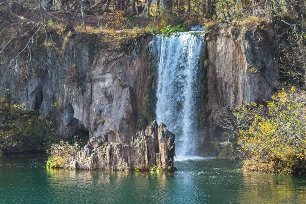
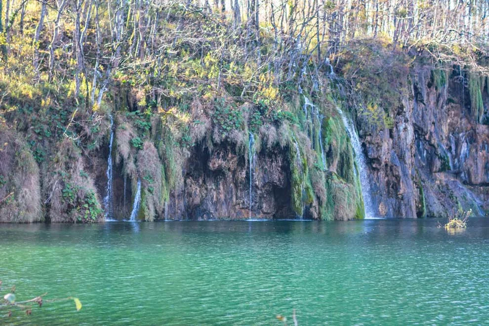
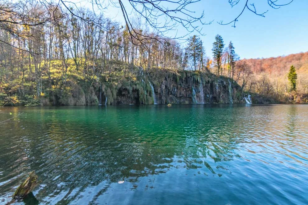
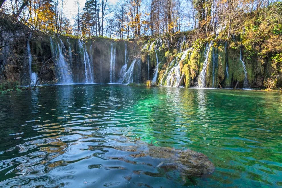


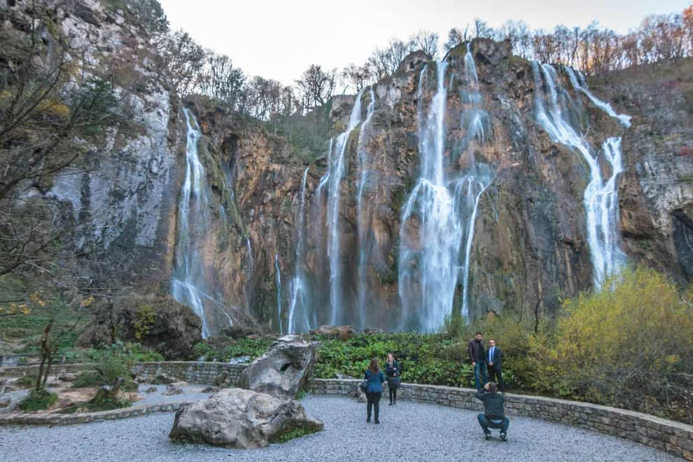
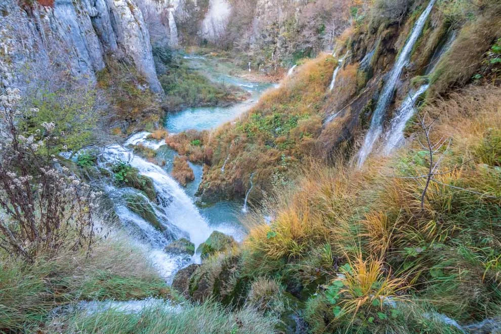
Plitvice Lakes are gorgeous. It was a breath of fresh air to be in the woods during foliage season, especially after all the urban living the past 8 months. Plitvice is no Iguazu Falls, (the best waterfalls I've ever seen) but it is a beautiful experience!
Next up, in Pt 2 --- Krka National Park! Stay tuned...